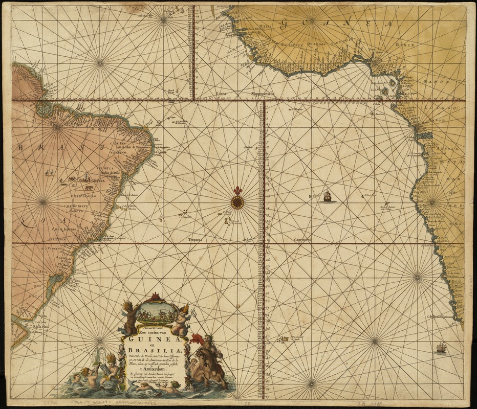
Pascaarte vande zee custen van Guinea, en Brasilia : van Cabo de Verde, tot C. de bona Esperanc̨a : van R. de Amazones tot Rio de la Plata, alles op wassende graaden gesteit t' Amsterdam
Item Information
- Title:
- Pascaarte vande zee custen van Guinea, en Brasilia : van Cabo de Verde, tot C. de bona Esperanc̨a : van R. de Amazones tot Rio de la Plata, alles op wassende graaden gesteit t' Amsterdam
- Creator:
- Keulen, Johannes van, 1654-1715
- Name on Item:
-
by Joannes van Keulen.
- Date:
-
[1680?]
- Format:
-
Maps/Atlases
- Location:
-
Boston Public Library
Norman B. Leventhal Map Center - Collection (local):
-
Norman B. Leventhal Map Center Collection
- Subjects:
-
Nautical charts--Early works to 1800
South Atlantic Ocean--Maps--Early works to 1800
New Guinea--Maps--Early works to 1800
Brazil--Maps--Early works to 1800
Cape Verde--Maps--Early works to 1800
- Places:
-
Cape Verde
Brazil
New Guinea (island)
Atlantic Ocean
- Extent:
- 1 map : col. ; 52 x 60 cm.
- Terms of Use:
-
No known copyright restrictions.
No known restrictions on use.
- Publisher:
-
Amsterdam :
Joannes van Keulen
- Scale:
-
Scale not given.
- Language:
-
Dutch
- Notes:
-
This is a sea chart with a variety of measuring scales and rhumb lines.
Includes elaborate cartouche.
From van Keulen's Zee-Atlas, appearing in editions from 1680 to 1709.
Cataloging, conservation, and digitization made possible in part by The National Endowment for the Humanities: Exploring the human endeavor.
- Identifier:
-
06_01_004757
- Call #:
-
G9166.P5 1680 .K4x
- Barcode:
-
39999059007425


