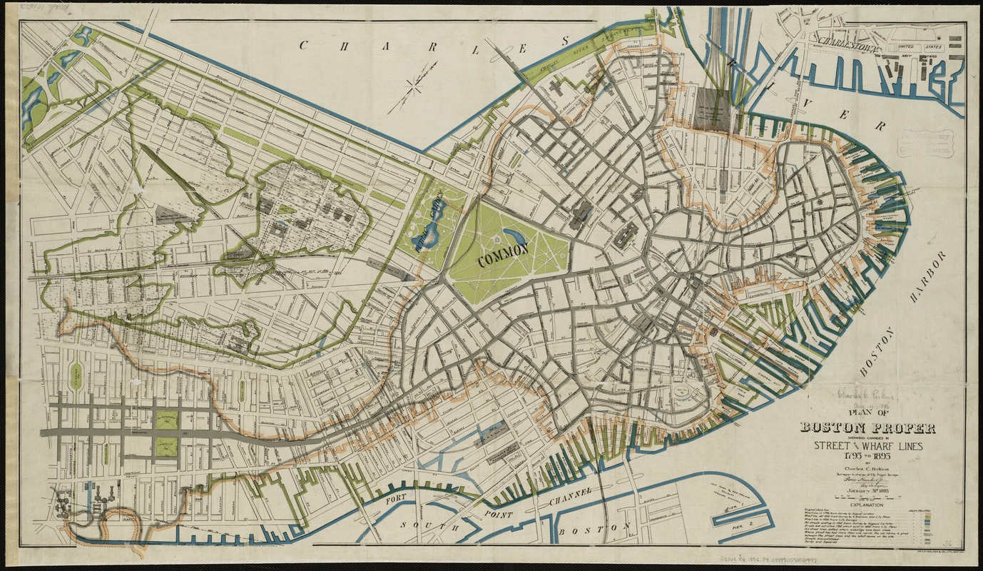
Plan of Boston proper : showing changes in street and wharf lines, 1795 to 1895
Item Information
- Title:
- Plan of Boston proper : showing changes in street and wharf lines, 1795 to 1895
- Cover title :
- Boston for 100 years
- Creator:
- Perkins, Charles Carroll.
- Name on Item:
-
Charles C. Perkins.
- Date:
-
1895
- Format:
-
Maps/Atlases
- Location:
-
Boston Public Library
Norman B. Leventhal Map Center - Collection (local):
-
Norman B. Leventhal Map Center Collection
- Subjects:
-
Cities and towns--Growth--Massachusetts--Boston--Maps
Wharves--Massachusetts--Boston--Maps
Streets--Massachusetts--Boston--Maps
Boston (Mass.)--Maps
Boston (Mass.)--Historical geography--Maps
- Places:
-
Suffolk (county)Boston
- Extent:
- 1 map : col. ; 53 x 94 cm.
- Terms of Use:
-
No known copyright restrictions.
No known restrictions on use.
- Publisher:
-
Boston :
Geo. H. Walker
- Scale:
-
Scale 1:4800.
- Language:
-
English
- Identifier:
-
06_01_004703
- Call #:
-
G3764.B6 1895 .P4
- Barcode:
-
39999059006997


