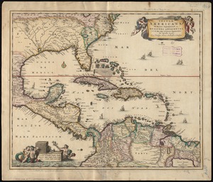
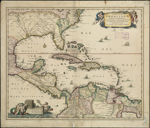
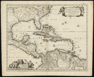
A map of the British Empire in America with the French and Spanish settlements adjacent thereto

Item Information
- Title:
- A map of the British Empire in America with the French and Spanish settlements adjacent thereto
- Cartographer:
- Popple, Henry, -1743
- Name on Item:
-
by Henry Popple
- Date:
-
[1733]
- Format:
-
Maps/Atlases
- Location:
-
Boston Public Library
Norman B. Leventhal Map Center - Collection (local):
-
Norman B. Leventhal Map Center Collection
- Subjects:
-
North America--Maps--Early works to 1800
Central America--Maps--Early works to 1800
West Indies--Maps--Early works to 1800
- Places:
-
CanadaNova Scotia (province)Annapolis Royal
MassachusettsBoston Harbor
CanadaNewfoundland and Labrador (province)Placentia Bay
CanadaQuebec (province)Québec
Illinois
Iowa
Wisconsin
Louisiana
Mississippi River
CanadaHudson Bay
Niagara Falls (waterfall)
JamaicaKingston (county)Kingston
JamaicaPortland (county)Port Antonio
CubaSantiago de Cuba (province)Santiago de Cuba
North Carolina
Virginia
South CarolinaCharleston (county)Charleston
New YorkNew York
BahamasNew Providence (island)Nassau
New JerseyMiddlesex (county)Perth Amboy
FloridaSaint Johns (county)Saint Augustine
Puerto Rico (territory)
West Indies
- Extent:
- 1 map on 20 sheets ; 232 x 237 cm, on sheets 49 x 68 cm or smaller, in portfolio 53 cm + index map (49 x 48 cm)
- Terms of Use:
-
No known copyright restrictions.
No known restrictions on use.
- Publisher:
-
London :
W.H. Toms & R.W. Seale
- Language:
-
English
- Notes:
-
Relief shown pictorially.
"C. Lempriere inv. & del., B. Baron sculp."
Accompanied by index map showing the whole assembled map.
Boston Public Library copy contains manuscript notation on Carolinas/Florida sheet: "Virginia - We know very well it hath often been said by the Virginians, that the great king of England, and the people of that colony, conquered the Indians who lived there, but it is not true. We will allow they have conquered the Sachdagughroonaw, and drove back the Tuscarroraws, and that they have, on that account, a Right to some Part of Virginia; but as to waht lies beyond the mountains, we conquered the nations residing there, and that Land, if the Virginians ever get a good Right to it, it must be by us...Speech of Tachanoontia, a chief of the six nations, at Lancaster in 1744, see Colden Histy. p 112."
- Notes (date):
-
This date is inferred.
- Identifier:
-
06_01_004569
06_01_005345 to 06_01_005364
- Call #:
-
G3290 .P6 1733
- Barcode:
-
39999059006807