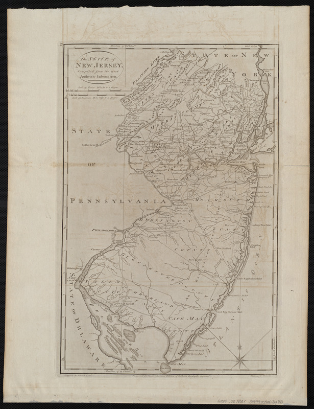
The state of New Jersey, compiled from the most authentic information
This map is also available in American Revolutionary Geographies Online (ARGO), a collections portal especially built for material relating to the American Revolutionary War Era. Visit ARGO to learn more about this item and explore the historical geography of North America in the late eighteenth century.
Item Information
- Title:
- The state of New Jersey, compiled from the most authentic information
- Creator:
- Lewis, Samuel, 1753 or 4-1822
- Cartographer:
- Lewis, Samuel, 1753 or 4-1822
- Engraver:
- Barker, W. (William), active 1795-1803
- Publisher:
- Carey, Mathew, 1760-1839
- Name on Item:
-
compiled by Samuel Lewis ; engraved by W. Barker
- Date:
-
[1800]
- Format:
-
Maps/Atlases
- Location:
-
Boston Public Library
Norman B. Leventhal Map Center - Collection (local):
-
Norman B. Leventhal Map Center Collection
- Subjects:
-
New Jersey--Maps
- Places:
-
New Jersey
- Extent:
- 1 map ; 47 x 30 cm
- Terms of Use:
-
No known copyright restrictions.
No known restrictions on use.
- Publisher:
-
[Philadelphia] :
[Mathew Carey]
- Scale:
-
Scale approximately 1:600,000
- Language:
-
English
- Notes:
-
Relief shown pictorially.
Prime meridian: Philadelphia.
"Engraved for Carey's American edition of Guthrie's Geography improved."
In upper left margin: 32.
Map 32 in his Carey's general atlas. Philadelphia : Mathew Carey, 1800.
- Notes (date):
-
This date is inferred.
- Identifier:
-
06_01_004551
- Call #:
-
G1015 .C3 1800x
- Barcode:
-
30000005056558


