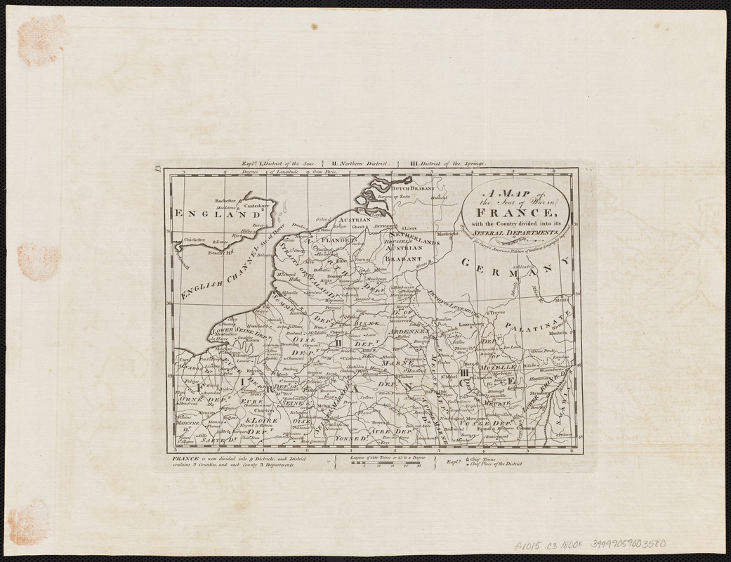
A map of the seat of war in France, with the country divided into its several departments
Item Information
- Title:
- A map of the seat of war in France, with the country divided into its several departments
- Engraver:
- Barker, W. (William), active 1795-1803
- Publisher:
- Carey, Mathew, 1760-1839
- Name on Item:
-
Wm. Barker sculp.
- Date:
-
[1800]
- Format:
-
Maps/Atlases
- Location:
-
Boston Public Library
Norman B. Leventhal Map Center - Collection (local):
-
Norman B. Leventhal Map Center Collection
- Subjects:
-
Belgium--Maps
France, Northern--Maps
Germany--Maps
Luxembourg--Maps
Netherlands--Maps
- Places:
-
Belgium
Luxembourg
France
Germany
Netherlands
- Extent:
- 1 map ; 16 x 24 cm
- Terms of Use:
-
No known copyright restrictions.
No known restrictions on use.
- Publisher:
-
[Philadelphia] :
[Mathew Carey]
- Scale:
-
Scale approximately 1:2,750,000
- Language:
-
English
- Notes:
-
Shows northern France, Luxembourg, Belgium and parts of the Netherlands and Germany.
Prime meridian: Paris.
"Engraved for Carey's American edition of Guthrie's Geography improved."
In upper left margin: 13.
Map 13 in his Carey's general atlas. Philadelphia : Mathew Carey, 1800.
- Notes (date):
-
This date is inferred.
- Identifier:
-
06_01_004532
- Call #:
-
G1015 .C3 1800x
- Barcode:
-
30000005056307