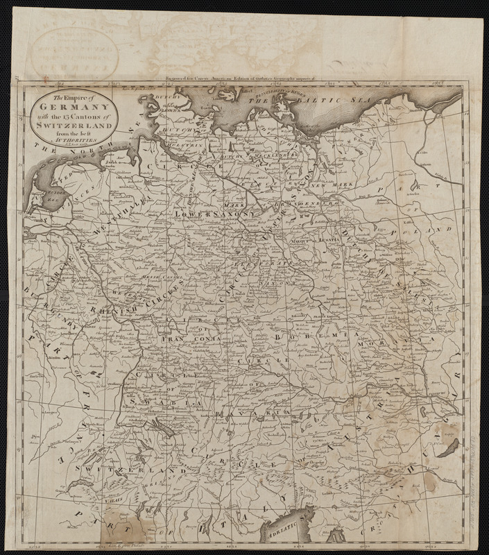
The empire of Germany with the 13 cantons of Switzerland from the best authorities
Item Information
- Title:
- The empire of Germany with the 13 cantons of Switzerland from the best authorities
- Engraver:
- Scott, J. T. (Joseph T.)
- Publisher:
- Carey, Mathew, 1760-1839
- Name on Item:
-
J.T. Scott sculp.
- Date:
-
[1800]
- Format:
-
Maps/Atlases
- Location:
-
Boston Public Library
Norman B. Leventhal Map Center - Collection (local):
-
Norman B. Leventhal Map Center Collection
- Subjects:
-
Germany (West)--Maps
Switzerland--Maps
- Places:
-
West Germany (former primary political entity)
Switzerland
- Extent:
- 1 map ; 42 x 40 cm
- Terms of Use:
-
No known copyright restrictions.
No known restrictions on use.
- Publisher:
-
[Philadelphia] :
[Mathew Carey]
- Scale:
-
Scale approximately 1:2,600,000
- Language:
-
English
- Notes:
-
Shows Switzerland and western Germany and parts of the Netherlands, Belgium, France and Italy.
Relief shown pictorially.
Prime meridians: Philadelphia and London.
"Engraved for Carey's American edition of Guthrie's Geography improved."
In upper left margin: 11.
Map 11 in his Carey's general atlas. Philadelphia : Mathew Carey, 1800.
- Notes (date):
-
This date is inferred.
- Identifier:
-
06_01_004530
- Call #:
-
G1015 .C3 1800x
- Barcode:
-
30000005056302