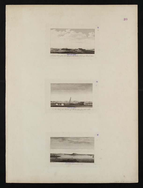
A front view of the lines taken from the advanced post near Browns house : A view of the harbour of Boston taken from Fort Hill ; A view of Boston from Dorchester Neck
This map is also available in American Revolutionary Geographies Online (ARGO), a collections portal especially built for material relating to the American Revolutionary War Era. Visit ARGO to learn more about this item and explore the historical geography of North America in the late eighteenth century.
Item Information
- Title:
- A front view of the lines taken from the advanced post near Browns house : A view of the harbour of Boston taken from Fort Hill ; A view of Boston from Dorchester Neck
- Title (alt.):
-
A view of the harbour of Boston taken from Fort Hill
A view of Boston from Dorchester Neck
- Creator:
- Des Barres, Joseph F. W. (Joseph Frederick Wallet), 1722-1824
- Date:
-
1775
- Format:
-
Maps/Atlases
- Location:
-
Boston Public Library
Norman B. Leventhal Map Center - Collection (local):
-
Norman B. Leventhal Map Center Collection
- Subjects:
-
Boston Harbor (Mass.)--History--18th century--Pictorial works
Boston (Mass.)--History--Revolution, 1775-1783--Pictorial works
- Places:
-
Boston Harbor
- Extent:
- 3 views on 1 sheet ; each 12 x 21 cm, on sheet 62 x 83 cm.
- Terms of Use:
-
No known copyright restrictions.
No known restrictions on use.
- Publisher:
-
[London] :
Published by J.F.W. Des Barres
- Scale:
-
Not drawn to scale.
- Language:
-
English
- Notes:
-
From the author's Atlantic Neptune.
- Identifier:
-
06_01_004516
- Call #:
-
G1106.P5 D47 1781
- Barcode:
-
30000003818442


