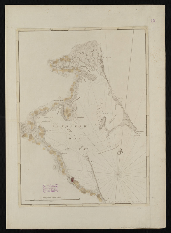
Chart of Plymouth Bay
This map is also available in American Revolutionary Geographies Online (ARGO), a collections portal especially built for material relating to the American Revolutionary War Era. Visit ARGO to learn more about this item and explore the historical geography of North America in the late eighteenth century.
Item Information
- Title:
- Chart of Plymouth Bay
- Description:
-
The chief product produced in colonial New England was dried cod. As a result, permanent, residential fishing settlements were established throughout New England in the 17th century, including one at Plymouth, Massachusetts. This 1781 chart illustrates the homesteads, roads, and topography in the vicinity of Plymouth. By the 1770s, the majority of the lower-quality dried cod produced in New England's offshore banks was being exported to the Caribbean, and served as a main food source for slaves working on sugar plantations. This cost-saving measure, coupled with profits from quality cod exported to Iberia, resulted in an abundance of wealth for New England fish merchants.
- Creator:
- Des Barres, Joseph F. W. (Joseph Frederick Wallet), 1722-1824
- Date:
-
[1770–1779]
- Format:
-
Maps/Atlases
- Location:
-
Boston Public Library
Norman B. Leventhal Map Center - Collection (local):
-
Norman B. Leventhal Map Center Collection
- Subjects:
-
Nautical charts--Massachusetts--Plymouth Bay--Early works to 1800
Plymouth Bay (Mass.)--Maps--Early works to 1800
- Places:
-
MassachusettsPlymouth (county)Plymouth Bay
- Extent:
- 1 chart : col. ; 67 x 49 cm.
- Terms of Use:
-
No known copyright restrictions.
No known restrictions on use.
- Publisher:
-
London :
J.F.W. Des Barres
- Edition:
- 2nd state.
- Scale:
-
Scale [ca. 1:24,000]
- Language:
-
English
- Notes:
-
Relief shown by hachures. Depths shown by soundings.
Appears in the author's Atlantic Neptune.
Variant of entry 960 in LC Maps of North America, 1750-1789.
"12" engraved in small oval in upper right corner of the border; lacks imprint.
- Notes (date):
-
This date is inferred.
- Notes (exhibitions):
-
Exhibited: "Charting an Empire: The Atlantic Neptune" organized by the Norman B. Leventhal Map Center at the Boston Public Library, 2013.
- Identifier:
-
06_01_004477
- Call #:
-
G1106.P5 D47 1781
- Barcode:
-
30000003808595


