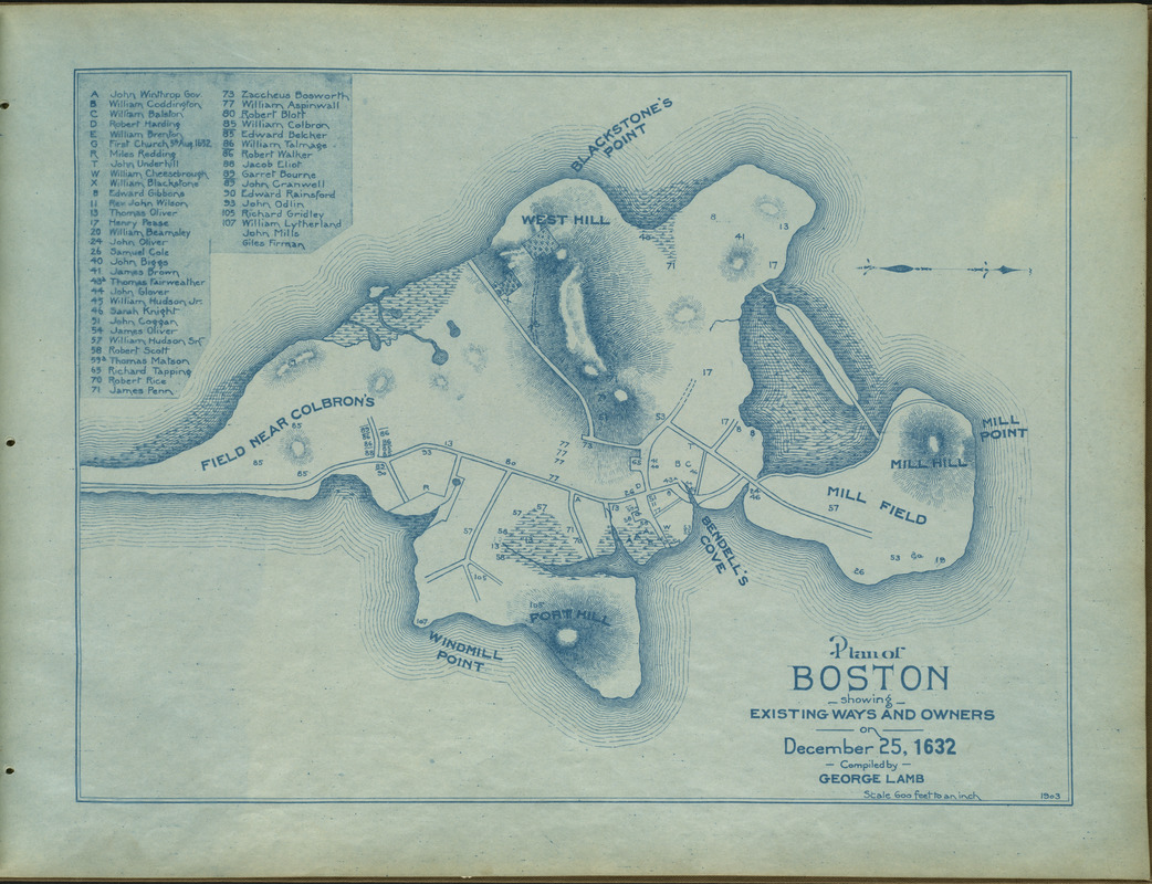
Plan of Boston showing existing ways and owners on December 25, 1632
Item Information
- Title:
- Plan of Boston showing existing ways and owners on December 25, 1632
- Cartographer:
- Lamb, George
- Date:
-
1903
- Format:
-
Maps/Atlases
- Location:
-
Boston Public Library
Norman B. Leventhal Map Center - Collection (local):
-
Norman B. Leventhal Map Center Collection
- Subjects:
-
Boston (Mass.)--Maps
Landowners--Massachusetts--Boston--Maps
- Places:
-
Suffolk (county)Boston
- Extent:
- 1 map : blue-line print ; 32 x 43 cm
- Terms of Use:
-
No known copyright restrictions.
No known restrictions on use.
- Publisher:
-
Boston :
[Publisher not identified]
- Scale:
-
Scale 1:7,200
- Language:
-
English
- Notes:
-
From A series of plans of Boston, showing existing ways and owners of property from December 25, 1630 to December 25, 1645 inclusive. Atlas published 1903.
- Identifier:
-
06_01_004437
- Call #:
-
G1234.B6 .L33 1903
- Barcode:
-
39999059006682


