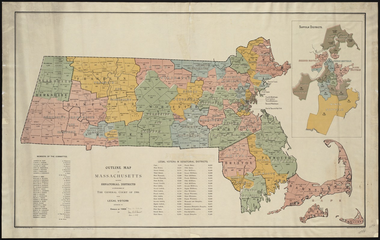
Outline map of Massachusetts showing senatorial districts as established by the General Court of 1906 with legal voters according to Census of 1905
Item Information
- Title:
- Outline map of Massachusetts showing senatorial districts as established by the General Court of 1906 with legal voters according to Census of 1905
- Date:
-
[1906]
- Format:
-
Maps/Atlases
- Location:
-
Boston Public Library
Norman B. Leventhal Map Center - Collection (local):
-
Norman B. Leventhal Map Center Collection
- Subjects:
-
Massachusetts. General Court. Senate--Election districts--Maps
Massachusetts--Administrative and political divisions--Maps
- Places:
-
Massachusetts
- Extent:
- 1 map : col. ; 59 x 96 cm.
- Terms of Use:
-
No known copyright restrictions.
No known restrictions on use.
- Publisher:
-
Boston, Mass :
s.n.
- Scale:
-
Scale not given.
- Language:
-
English
- Notes:
-
Includes lists of the Members of the Committee and the number of legal voters in senatorial districts.
Inset: Suffolk districts.
"Geo. H. Walker & Co. Lith. Boston."
"Wright & Potter Printing Co."
- Notes (date):
-
This date is inferred.
- Identifier:
-
06_01_004402
- Call #:
-
G3761.F7 1906 .O9
- Barcode:
-
39999058996297