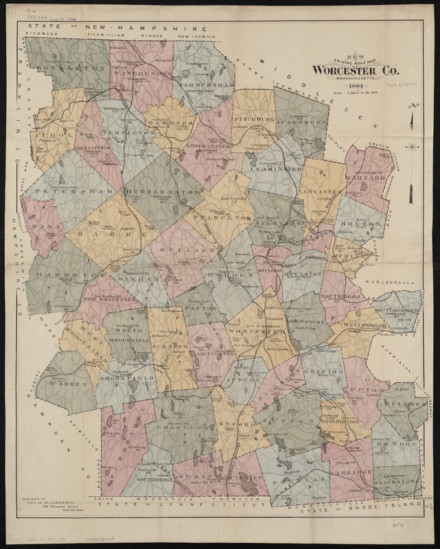
New driving road map of Worcester Co. Massachusetts
Item Information
- Title:
- New driving road map of Worcester Co. Massachusetts
- Creator:
- Geo. H. Walker & Co
- Date:
-
1884
- Format:
-
Maps/Atlases
- Location:
-
Boston Public Library
Norman B. Leventhal Map Center - Collection (local):
-
Norman B. Leventhal Map Center Collection
- Subjects:
-
Worcester County (Mass.)--Maps
- Places:
-
Worcester (county)
- Extent:
- 1 map : col. ; 65 x 54 cm.
- Terms of Use:
-
No known copyright restrictions.
No known restrictions on use.
- Publisher:
-
Boston :
Geo. H. Walker & Co.
- Scale:
-
Scale 1:126,720.
- Language:
-
English
- Notes:
-
Shows the post office in each town, and railroad routes throughout the County.
- Identifier:
-
06_01_004397
- Call #:
-
G3763.W6 1884 .W3x
- Barcode:
-
39999059006468


