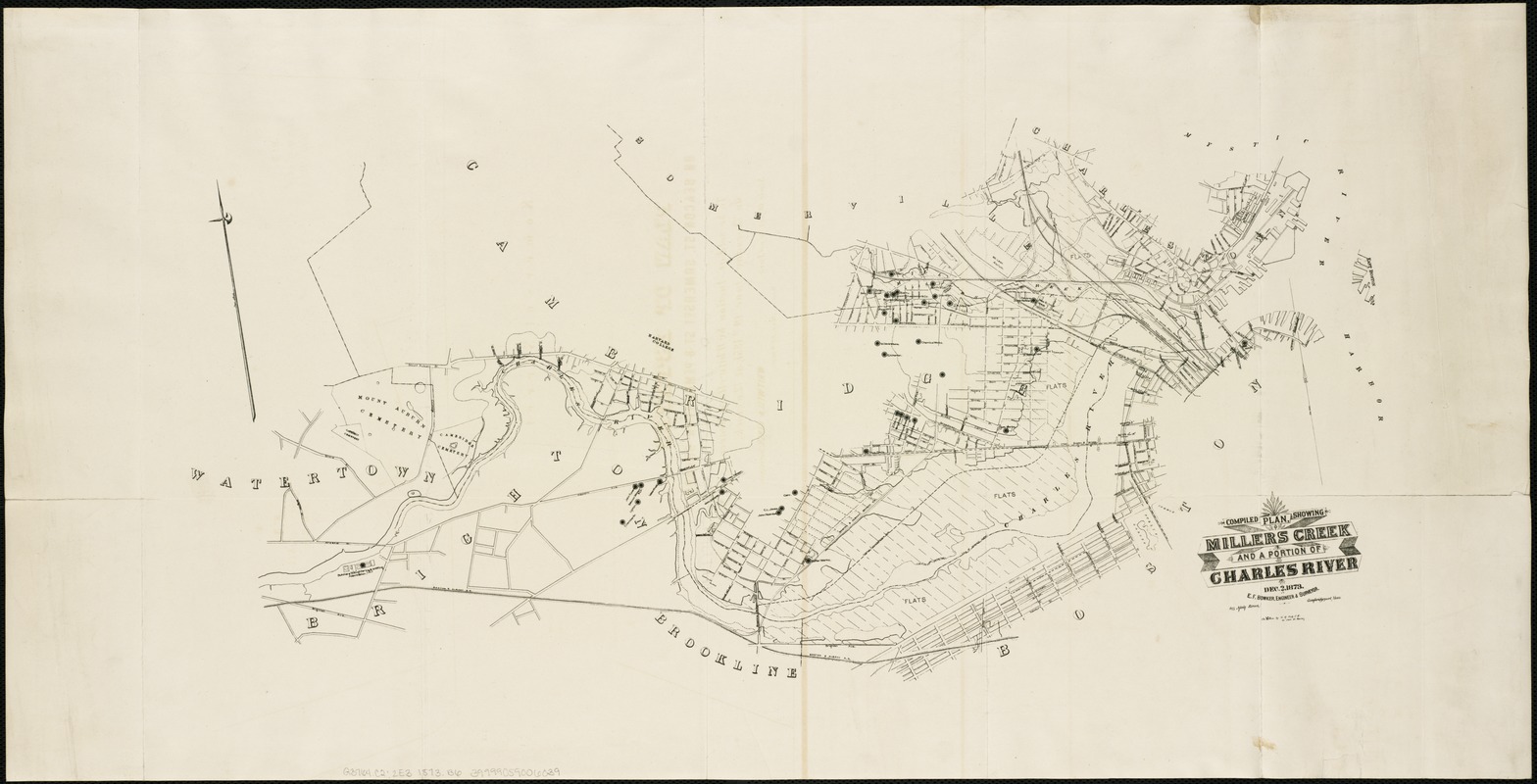
Compiled plan, showing Millers Creek and a portion of Charles River
Item Information
- Title:
- Compiled plan, showing Millers Creek and a portion of Charles River
- Creator:
- Bowker, E. F.
- Name on Item:
-
E.F. Bowker, engineer & surveyor.
- Date:
-
1873
- Format:
-
Maps/Atlases
- Location:
-
Boston Public Library
Norman B. Leventhal Map Center - Collection (local):
-
Norman B. Leventhal Map Center Collection
- Subjects:
-
East Cambridge (Cambridge, Mass.)--Maps
Charles River (Mass.)--Maps
Cambridge (Mass.)--Maps
- Places:
-
Charles (river)
Middlesex (county)CambridgeEast Cambridge
- Extent:
- 1 map ; on sheet 36 x 70 cm.
- Terms of Use:
-
No known copyright restrictions.
No known restrictions on use.
- Publisher:
-
Boston :
W.R. Fish
- Scale:
-
Scale [1:4,800].
- Language:
-
English
- Notes:
-
Oriented with north toward the upper left.
Shows Charles River flats, U.S. Harbor Commissioners' line, and locations of some businesses and residents.
Covers areas along Millers Creek and Charles River in Cambridge and parts of Brighton, Somerville, Charlestown, and Boston.
"Dec. 2, 1873."
- Identifier:
-
06_01_004313
- Call #:
-
G3764.C2:2E3 1873 .B6
- Barcode:
-
39999059006039


