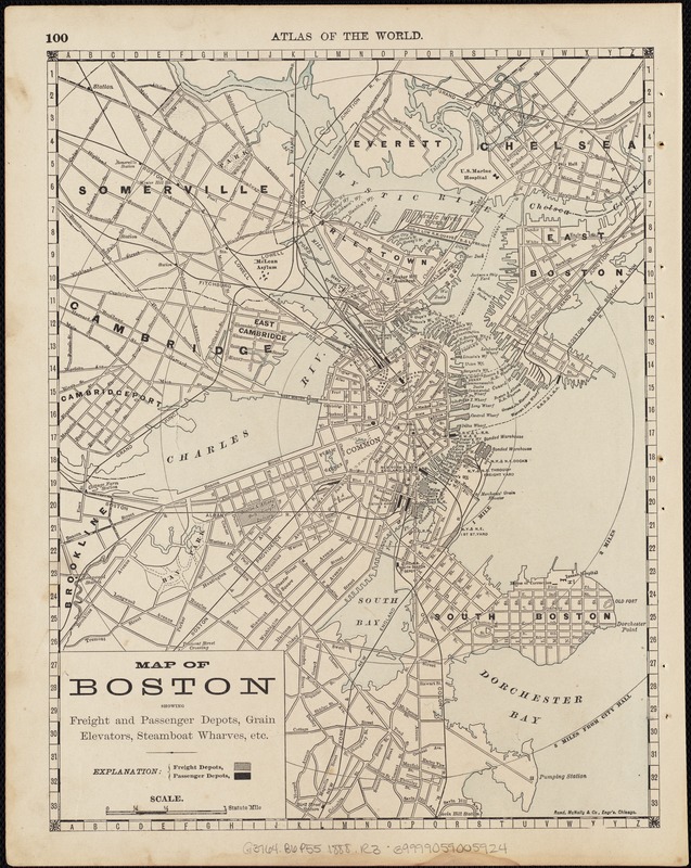
Map of Boston : showing freight and passenger depots, grain elevators, steamboat wharves, etc
Item Information
- Title:
- Map of Boston : showing freight and passenger depots, grain elevators, steamboat wharves, etc
- Title in top margin :
- Atlas of the World
- Creator:
- Rand McNally and Company
- Date:
-
[1888?]
- Format:
-
Maps/Atlases
- Location:
-
Boston Public Library
Norman B. Leventhal Map Center - Collection (local):
-
Norman B. Leventhal Map Center Collection
- Subjects:
-
Terminals (Transportation)--Massachusetts--Boston--Maps
Wharves--Massachusetts--Boston--Maps
Grain elevators--Massachusetts--Boston--Maps
Boston (Mass.)--Maps
- Places:
-
Suffolk (county)Boston
- Extent:
- 1 map : col. ; 31 x 24 cm.
- Terms of Use:
-
No known copyright restrictions.
No known restrictions on use.
- Publisher:
-
Chicago :
Rand McNally
- Scale:
-
Scale [ca. 1:33,000].
- Language:
-
English
- Notes:
-
Covers 3-mile area surrounding Boston city hall.
"100."
Ill., and "99" on verso.
- Identifier:
-
06_01_004299
- Call #:
-
G3764.B6P55 1888 .R3
- Barcode:
-
39999059005924


