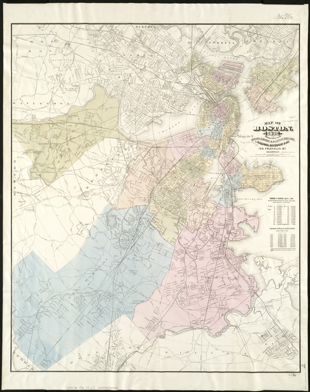
Map of Boston, for 1876
Item Information
- Title:
- Map of Boston, for 1876
- Creator:
- Sampson, Davenport & Co
- Date:
-
[1876]
- Format:
-
Maps/Atlases
- Location:
-
Boston Public Library
Norman B. Leventhal Map Center - Collection (local):
-
Norman B. Leventhal Map Center Collection
- Subjects:
-
Boston (Mass.)--Maps
- Places:
-
Suffolk (county)Boston
- Extent:
- 1 map : hand col. ; 82 x 67 cm.
- Terms of Use:
-
No known copyright restrictions.
No known restrictions on use.
- Publisher:
-
Boston :
Sampson, Davenport & Co.
- Scale:
-
Scale [1:19,800].
- Language:
-
English
- Notes:
-
Covers parts of adjacent towns and cities, including all of Cambridge, Somerville, and Brookline.
"Entered according to Act of Congress in the year 1875 by Sampson, Davenport & Co. in the Office of the Librarian of Congress at Washington."
"Published expressly for the Boston almanac & Boston directory."
"J.H. Bufford's Sons Lith."
Distance from City Hall shown by concentric circles at half mile intervals.
Includes table of population of Boston for various periods.
- Notes (date):
-
This date is inferred.
- Identifier:
-
06_01_004279
- Call #:
-
G3764.B6 1876 .S3
- Barcode:
-
39999059005551


