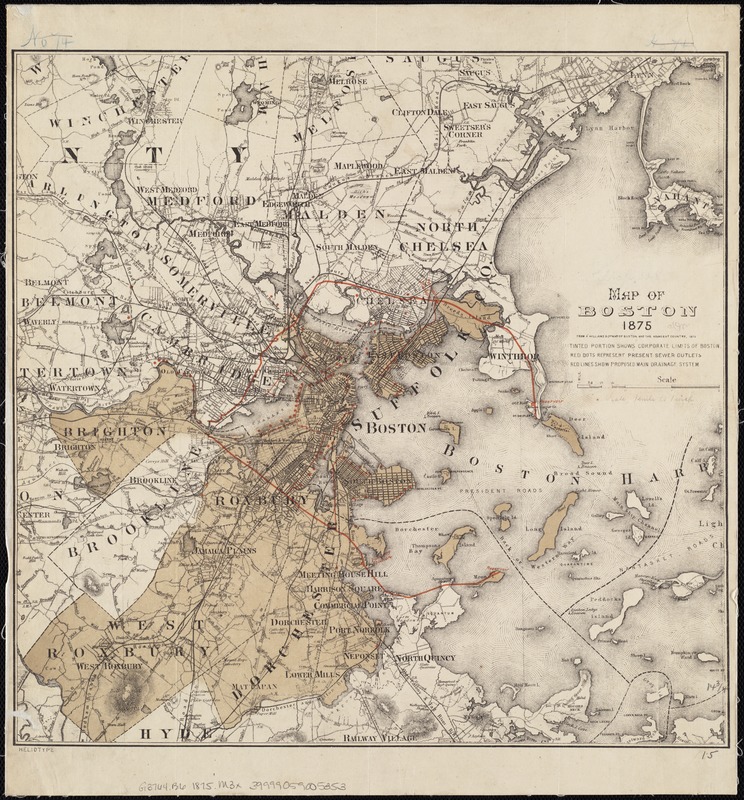
Map of Boston 1875 : from A. Williams & Cos. map of Boston and the adjacent country, 1872
Item Information
- Title:
- Map of Boston 1875 : from A. Williams & Cos. map of Boston and the adjacent country, 1872
- Date:
-
[1875]
- Format:
-
Maps/Atlases
- Location:
-
Boston Public Library
Norman B. Leventhal Map Center - Collection (local):
-
Norman B. Leventhal Map Center Collection
- Subjects:
-
Sewerage--Massachusetts--Boston--Maps
Boston (Mass.)--Maps
Massachusetts--Maps
Boston (Mass.)--Administrative and political divisions--Maps
- Places:
-
Suffolk (county)Boston
- Extent:
- 1 map : col. ; 37 x 39 cm.
- Terms of Use:
-
No known copyright restrictions.
No known restrictions on use.
- Publisher:
-
Boston :
Heliotype Printing Co.
- Scale:
-
Scale 1:63,360.
- Language:
-
English
- Notes:
-
Relief shown by hachures.
"Tinted portion shows corporate limits of Boston. Red dots repesent present sewer outlets. Red lines show proposed main drainage system."
- Notes (date):
-
This date is inferred.
- Identifier:
-
06_01_004252
- Call #:
-
G3764.B6 1875 .M3x
- Barcode:
-
39999059005353


