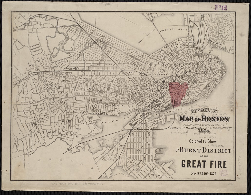
Russell's map of Boston from the latest surveys : colored to show the burned district of the Great Fire Nov 9th & 10th 1872
Item Information
- Title:
- Russell's map of Boston from the latest surveys : colored to show the burned district of the Great Fire Nov 9th & 10th 1872
- Title (alt.):
-
Map of Boston from the latest surveys
- Creator:
- Russell, B. B. (Benjamin B.)
- Date:
-
1872
- Format:
-
Maps/Atlases
- Location:
-
Boston Public Library
Norman B. Leventhal Map Center - Collection (local):
-
Norman B. Leventhal Map Center Collection
- Subjects:
-
Great Fire, Boston, Mass., 1872--Maps
Boston (Mass.)--Maps
- Places:
-
Suffolk (county)Boston
- Extent:
- 1 map : col. ; 41 x 54 cm.
- Terms of Use:
-
No known copyright restrictions.
No known restrictions on use.
- Publisher:
-
Boston :
B.B. Russell
- Scale:
-
Scale 1:12,000.
- Language:
-
English
- Identifier:
-
06_01_004241
- Call #:
-
G3764.B6E29 1872 .R8x
- Barcode:
-
39999059005197


