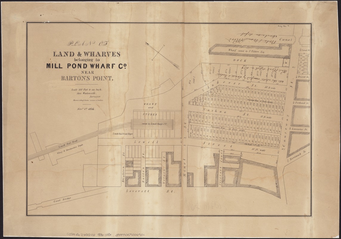
Plan of land & wharves belonging to Mill Pond Wharf Co. near Bartons Point
Item Information
- Title:
- Plan of land & wharves belonging to Mill Pond Wharf Co. near Bartons Point
- Title (alt.):
-
Plan of land and wharves belonging to Mill Pond Wharf Co. near Bartons Point
- Creator:
- Wadsworth, Alexander, 1806-1898
- Name on Item:
-
Alex. Wadsworth.
- Date:
-
1836
- Format:
-
Maps/Atlases
- Location:
-
Boston Public Library
Norman B. Leventhal Map Center - Collection (local):
-
Norman B. Leventhal Map Center Collection
- Subjects:
-
Landowners--Massachusetts--Boston--West End--Maps
Real property--Massachusetts--Boston--Maps
Real estate development--Massachusetts--Boston--Maps
Boston (Mass.)--Maps
West End (Boston, Mass.)--Maps
West End (Boston, Mass.)
- Places:
-
Suffolk (county)Boston
- Extent:
- 1 plan ; 34 x 51 cm.
- Terms of Use:
-
No known copyright restrictions.
No known restrictions on use.
- Publisher:
-
Boston :
[s.n.]
- Scale:
-
Scale 1:1,200.
- Language:
-
English
- Notes:
-
Oriented with north toward the upper left.
"Novr. 1st 1836."
"Moore's Lithogy. Boston."
- Identifier:
-
06_01_004199
- Call #:
-
G3764.B6:2W3G46 1836 .W3x
- Barcode:
-
39999059004901