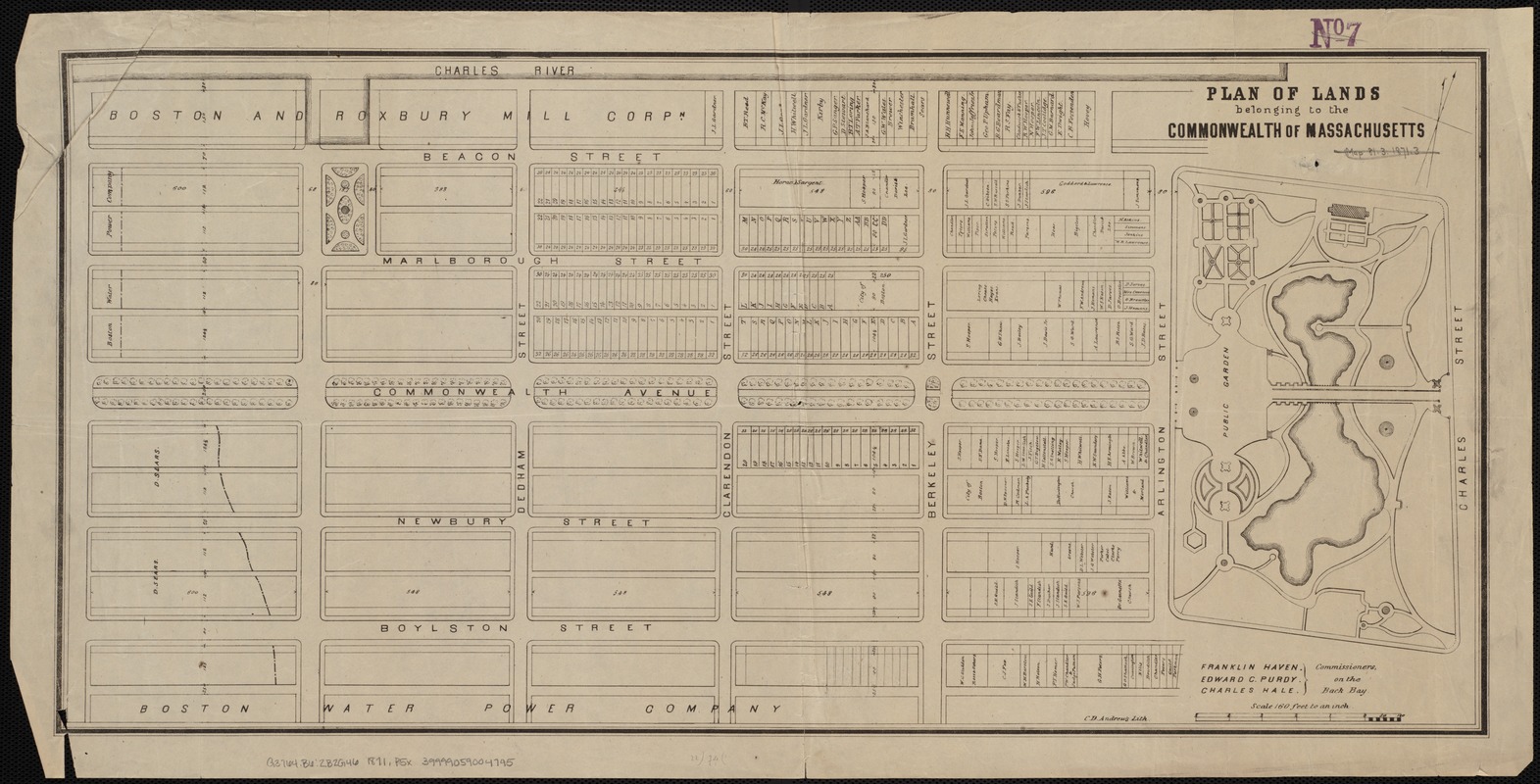
Plan of lands belonging to the Commonwealth of Massachusetts
Item Information
- Title:
- Plan of lands belonging to the Commonwealth of Massachusetts
- Date:
-
[1871]
- Format:
-
Maps/Atlases
- Location:
-
Boston Public Library
Norman B. Leventhal Map Center - Collection (local):
-
Norman B. Leventhal Map Center Collection
- Subjects:
-
Landowners--Massachusetts--Boston--Maps
Real property--Massachusetts--Boston--Maps
Boston (Mass.)--Maps
- Places:
-
Suffolk (county)Boston
- Extent:
- 1 plan ; 31 x 64 cm.
- Terms of Use:
-
No known copyright restrictions.
No known restrictions on use.
- Publisher:
-
Boston :
s.n.
- Scale:
-
Scale 1: 1,920.
- Language:
-
English
- Notes:
-
Oriented with north toward the upper right.
"C.D. Andrews Lith."
"Franklin Haven, Edward C. Purdy, Charles Hale Commissioners, on the Back Bay."
- Notes (date):
-
This date is inferred.
- Identifier:
-
06_01_004180
- Call #:
-
G3764.B6:2B2G46 1871 .P5x
- Barcode:
-
39999059004745


