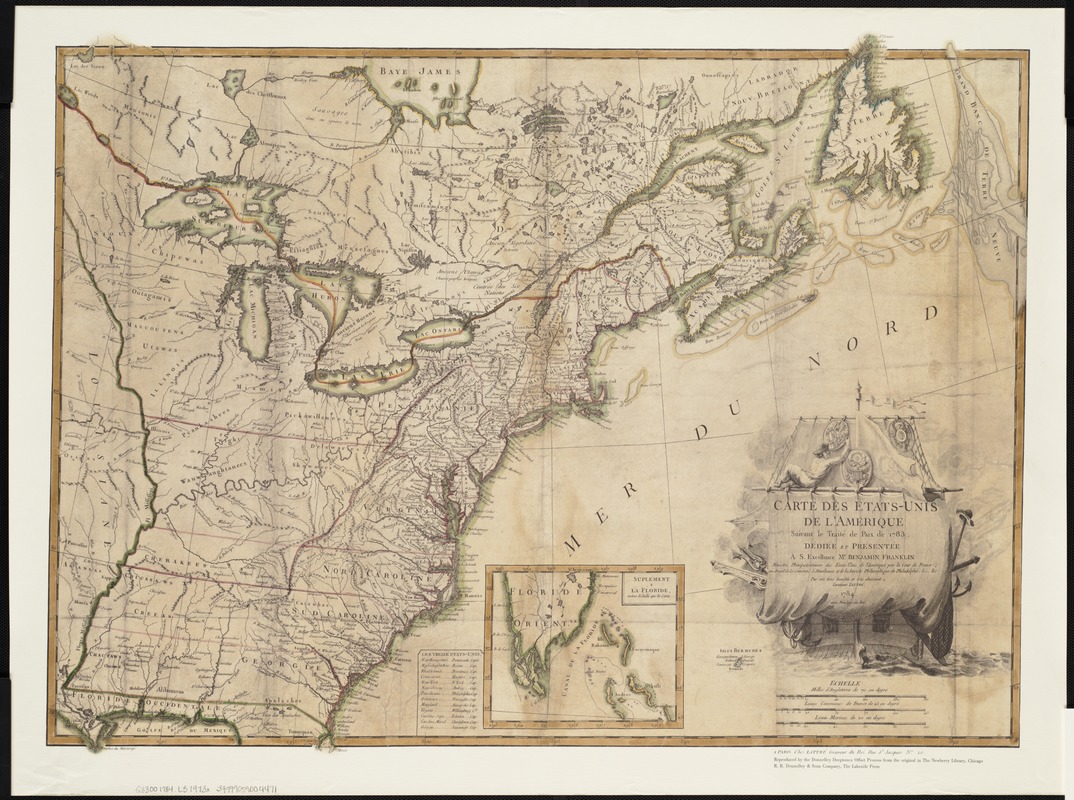
Carte des Etats-Unis de l'Amerique suivant le Traité de Paix de 1783 : dédiée et présentée a S. Excellence Mr. Benjamin Franklin
This map is also available in American Revolutionary Geographies Online (ARGO), a collections portal especially built for material relating to the American Revolutionary War Era. Visit ARGO to learn more about this item and explore the historical geography of North America in the late eighteenth century.
Item Information
- Title:
- Carte des Etats-Unis de l'Amerique suivant le Traité de Paix de 1783 : dédiée et présentée a S. Excellence Mr. Benjamin Franklin
- Creator:
- Lattré, Jean.
- Name on Item:
-
par son tres humble et tres obeissant serviteur Lattré.
- Date:
-
[1973?]
- Format:
-
Maps/Atlases
- Location:
-
Boston Public Library
Norman B. Leventhal Map Center - Collection (local):
-
Norman B. Leventhal Map Center Collection
- Subjects:
-
United States--Maps--Early works to 1800--Facsimiles
- Places:
-
- Extent:
- 1 map : col. ; 56 x 75 cm.
- Terms of Use:
-
Under copyright.
All rights reserved.
- Publisher:
-
[Chicago] :
R.R. Donnelley & Sons
- Scale:
-
Scale [ca. 1:4,750,000].
- Language:
-
French
- Notes:
-
Facsimile.
Inset: Suplément a la Floride.
Accompanied by: The first French map of the United States of America, by Lester J. Cappon. [7] p.
"Reproduced by the Donnelley Deeptone-Offset Process from the original in the Newberry Library, Chicago."
Relief shown pictorially.
Original version: Paris : Lattré, 1784.
- Identifier:
-
06_01_004157
- Call #:
-
G3300 1784 .L3 1973x
- Barcode:
-
39999059004471