A plan of sundry farms etc. at Patucket in the town of Chelmsford
Item Information
- Title:
- A plan of sundry farms etc. at Patucket in the town of Chelmsford
- Description:
-
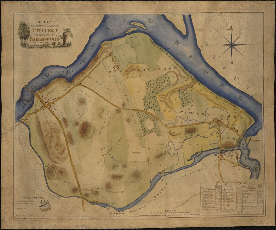
Lithographed wall map of Cheever's, Fletcher's and Tyler's farms. Inset with identification of different sections and acreage.
- Creator:
- Hales, John Groves
- Name on Item:
-
Jno. G. Hales.
- Date:
-
[1871]
- Format:
-
Maps/Atlases
- Location:
-
Boston Public Library
Norman B. Leventhal Map Center - Collection (local):
-
Norman B. Leventhal Map Center Collection
- Subjects:
-
Real property--Massachusetts--Chelmsford--Maps
Land tenure--Massachusetts--Chelmsford--Maps
Chelmsford (Mass.)--Maps
- Places:
-
MassachusettsMiddlesex (county)Chelmsford Center
- Extent:
- 1 map : col. ; 58 x 71 cm.
- Terms of Use:
-
No known copyright restrictions.
No known restrictions on use.
- Publisher:
-
Boston [Mass.] :
New England Lithography
- Scale:
-
Scale [ca. 1:3,360]
- Language:
-
English
- Notes:
-
Relief shown by hachures.
Originally published in 1821.
"Reduced from the original plan, for the Props. of Locks & Canals on Merrimack River, Nov. 1871."
- Notes (date):
-
This date is inferred.
- Identifier:
-
06_01_004118
- Call #:
-
G3764.C38G46 1871 .H3x
- Barcode:
-
39999059003986


