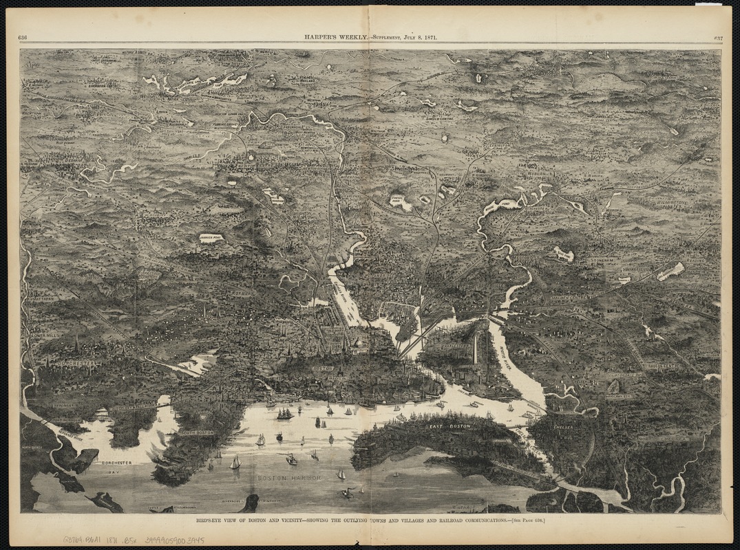
Birds-eye view of Boston and vicinity : showing the outlying towns and villages and railroad communications
Item Information
- Title:
- Birds-eye view of Boston and vicinity : showing the outlying towns and villages and railroad communications
- Date:
-
1871
- Format:
-
Maps/Atlases
- Location:
-
Boston Public Library
Norman B. Leventhal Map Center - Collection (local):
-
Norman B. Leventhal Map Center Collection
- Subjects:
-
Boston (Mass.)--Aerial views
Massachusetts--Aerial views
- Places:
-
Suffolk (county)Boston
- Extent:
- 1 view ; 35 x 52 cm.
- Terms of Use:
-
No known copyright restrictions.
No known restrictions on use.
- Publisher:
-
New York :
[Harper & Brothers]
- Scale:
-
Not drawn to scale.
- Language:
-
English
- Notes:
-
Appears in Harper's Weekly supplement, July 8, 1871.
- Identifier:
-
06_01_004114
- Call #:
-
G3764.B6A3 1871 .B5x
- Barcode:
-
39999059003945


