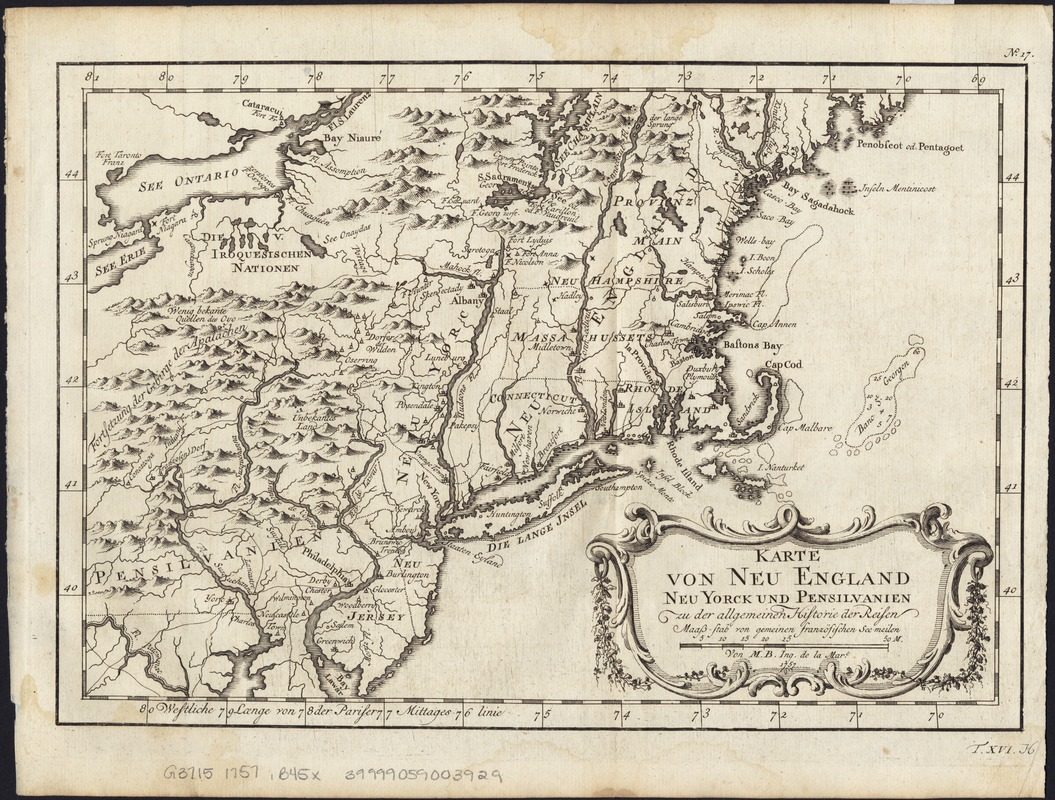
Karte von Neu England, Neu Yorck und Pensilvanien : sur Allgemeinen historie der reisen
This map is also available in American Revolutionary Geographies Online (ARGO), a collections portal especially built for material relating to the American Revolutionary War Era. Visit ARGO to learn more about this item and explore the historical geography of North America in the late eighteenth century.
Item Information
- Title:
- Karte von Neu England, Neu Yorck und Pensilvanien : sur Allgemeinen historie der reisen
- Creator:
- Bellin, Jacques Nicolas, 1703-1772
- Name on Item:
-
von M.B., Ing. de la mar.
- Date:
-
1757
- Format:
-
Maps/Atlases
- Location:
-
Boston Public Library
Norman B. Leventhal Map Center - Collection (local):
-
Norman B. Leventhal Map Center Collection
- Subjects:
-
Northeastern States--Maps--Early works to 1800
Pennsylvania--Maps--Early works to 1800
New York (State)--Maps--Early works to 1800
- Places:
-
Pennsylvania
Northeastern United States (area)
New York
- Extent:
- 1 map ; 19 x 28 cm.
- Terms of Use:
-
No known copyright restrictions.
No known restrictions on use.
- Publisher:
-
S.l :
[s.n.]
- Scale:
-
Scale [ca. 1:1,300,000].
- Language:
-
German
- Notes:
-
Relief shown pictorially.
Prime meridian: Paris.
Upper right corner: "No. 17."
Lower right corner: "T. XVI. H."
Possibly detached from: Allgemeine historie der reisen (Leipzig : Bey Arkstee aund Merkus, 1757).
- Identifier:
-
06_01_004111
- Call #:
-
G3715 1757 .B45x
- Barcode:
-
39999059003929


