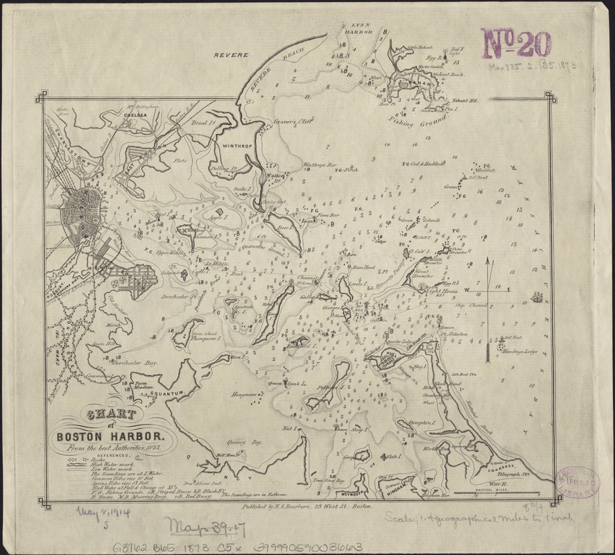
Chart of Boston Harbor : from the best authorities, 1873
Item Information
- Title:
- Chart of Boston Harbor : from the best authorities, 1873
- Date:
-
[1873]
- Format:
-
Maps/Atlases
- Location:
-
Boston Public Library
Norman B. Leventhal Map Center - Collection (local):
-
Norman B. Leventhal Map Center Collection
- Subjects:
-
Boston Harbor (Mass.)--Maps
- Places:
-
Boston Harbor
- Extent:
- 1 chart ; 21 x 22 cm.
- Terms of Use:
-
No known copyright restrictions.
No known restrictions on use.
- Publisher:
-
Boston [Mass.] :
N.S. Dearborn
- Scale:
-
Scale ca. 1:88,704.
- Language:
-
English
- Notes:
-
Depths shown by soundings.
- Notes (date):
-
This date is inferred.
- Identifier:
-
06_01_004097
- Call #:
-
G3762.B65 1873 .C5x
- Barcode:
-
39999059003663


