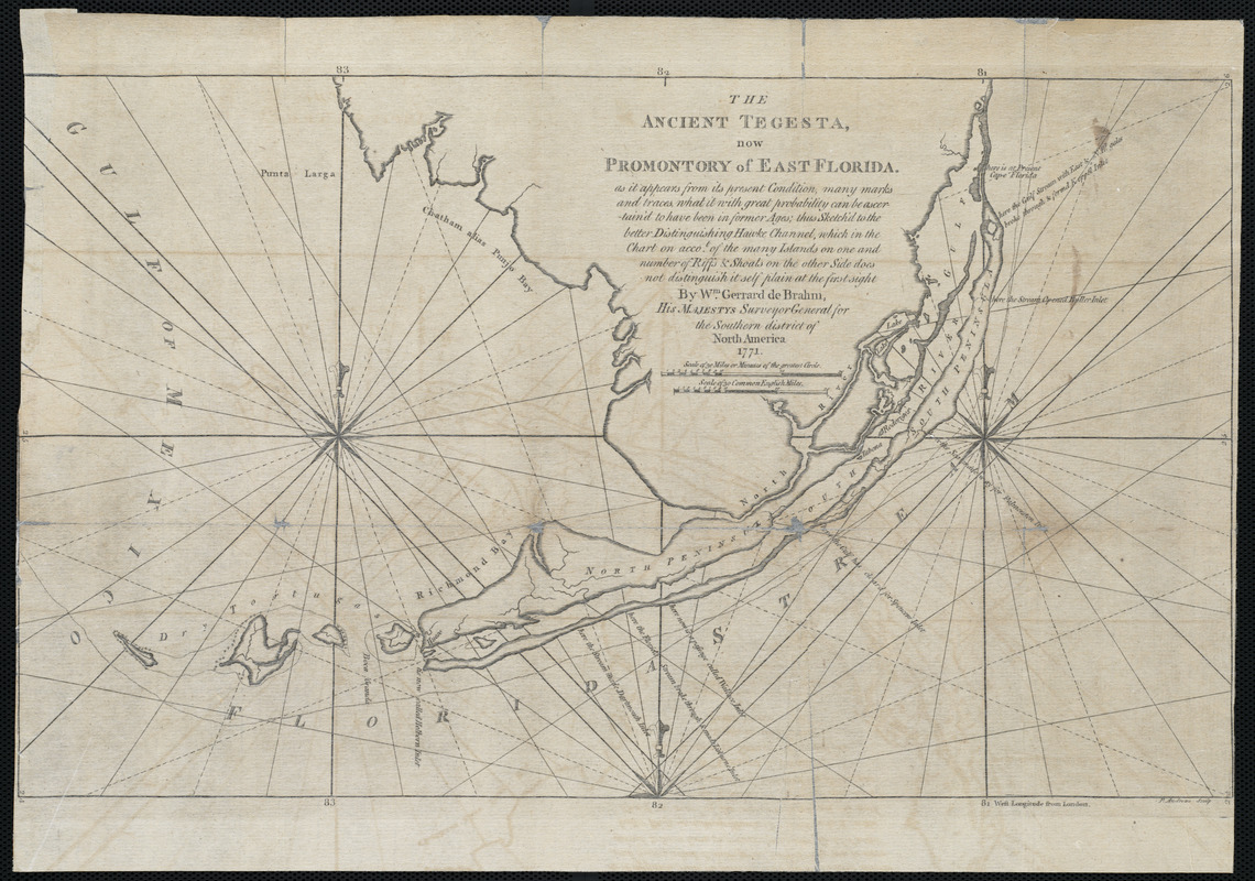
The Ancient Tegesta, now promontory of East Florida
This map is also available in American Revolutionary Geographies Online (ARGO), a collections portal especially built for material relating to the American Revolutionary War Era. Visit ARGO to learn more about this item and explore the historical geography of North America in the late eighteenth century.
Item Information
- Title:
- The Ancient Tegesta, now promontory of East Florida
- Title (alt.):
-
The Atlantic Pilot
- Creator:
- De Brahm, John Gerar William, 1717-ca. 1799
- Contributor:
- Andrews, Peter, active 1765-1782
- Name on Item:
-
by William Gerrard de Brahm ; P. Andrews sculp.
- Date:
-
1771
- Format:
-
Maps/Atlases
- Location:
-
Boston Public Library
Norman B. Leventhal Map Center - Collection (local):
-
Norman B. Leventhal Map Center Collection
- Subjects:
-
Nautical charts--Florida--Florida Keys--Early works to 1800
Florida Keys (Fla.)--Maps--Early works to 1800
- Places:
-
Monroe (county)Florida Keys (area)
- Extent:
- 1 map ; 28 x 47 cm.
- Terms of Use:
-
No known copyright restrictions.
No known restrictions on use.
- Publisher:
-
London :
[s.n.]
- Scale:
-
Scale ca. 1:800000
- Language:
-
English
- Notes:
-
From the author's Atlantic pilot. London, 1772.
Atlas scanned by Internet Archive http://archive.org/stream/atlanticpilotcardebr
- Identifier:
-
06_01_004096
- Call #:
-
G1316.P5 .B7 1772x
- Barcode:
-
30000003245681


