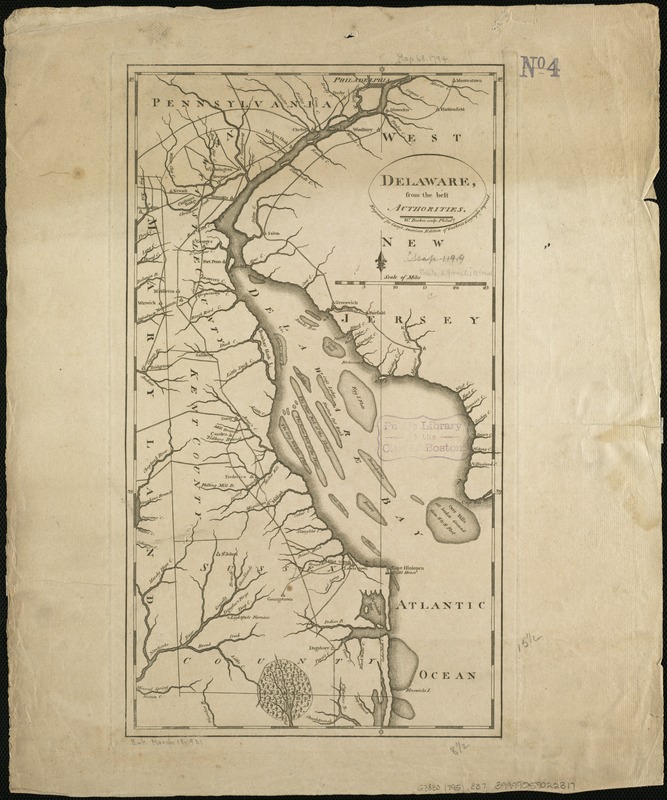
Delaware, from the best authorities
This map is also available in American Revolutionary Geographies Online (ARGO), a collections portal especially built for material relating to the American Revolutionary War Era. Visit ARGO to learn more about this item and explore the historical geography of North America in the late eighteenth century.
Item Information
- Title:
- Delaware, from the best authorities
- Creator:
- Carey, Mathew, 1760-1839
- Name on Item:
-
W. Barker sculp. ; engraved for Carey's American edition of Guthrie's geography improved.
- Date:
-
[1795]
- Format:
-
Maps/Atlases
- Location:
-
Boston Public Library
Norman B. Leventhal Map Center - Collection (local):
-
Norman B. Leventhal Map Center Collection
- Subjects:
-
Delaware--Maps--Early works to 1800
Delaware Bay (Del. and N.J.)--Maps--Early works to 1800
- Places:
-
Delaware Bay
Delaware
- Extent:
- 1 map ; 40 x 22 cm.
- Terms of Use:
-
No known copyright restrictions.
No known restrictions on use.
- Publisher:
-
Philadelphia :
M. Carey
- Scale:
-
Scale [ca.1:450,000].
- Language:
-
English
- Notes:
-
Covers also Delaware Bay, west New Jersey, Pennsylvania, and Maryland.
Shows names of counties, towns, cities, drainage, and points of interest.
State I according to Wheat & Brun.
- Notes (date):
-
This date is inferred.
- Identifier:
-
06_01_004074
- Call #:
-
G3830 1795 .C37
- Barcode:
-
39999059022317


