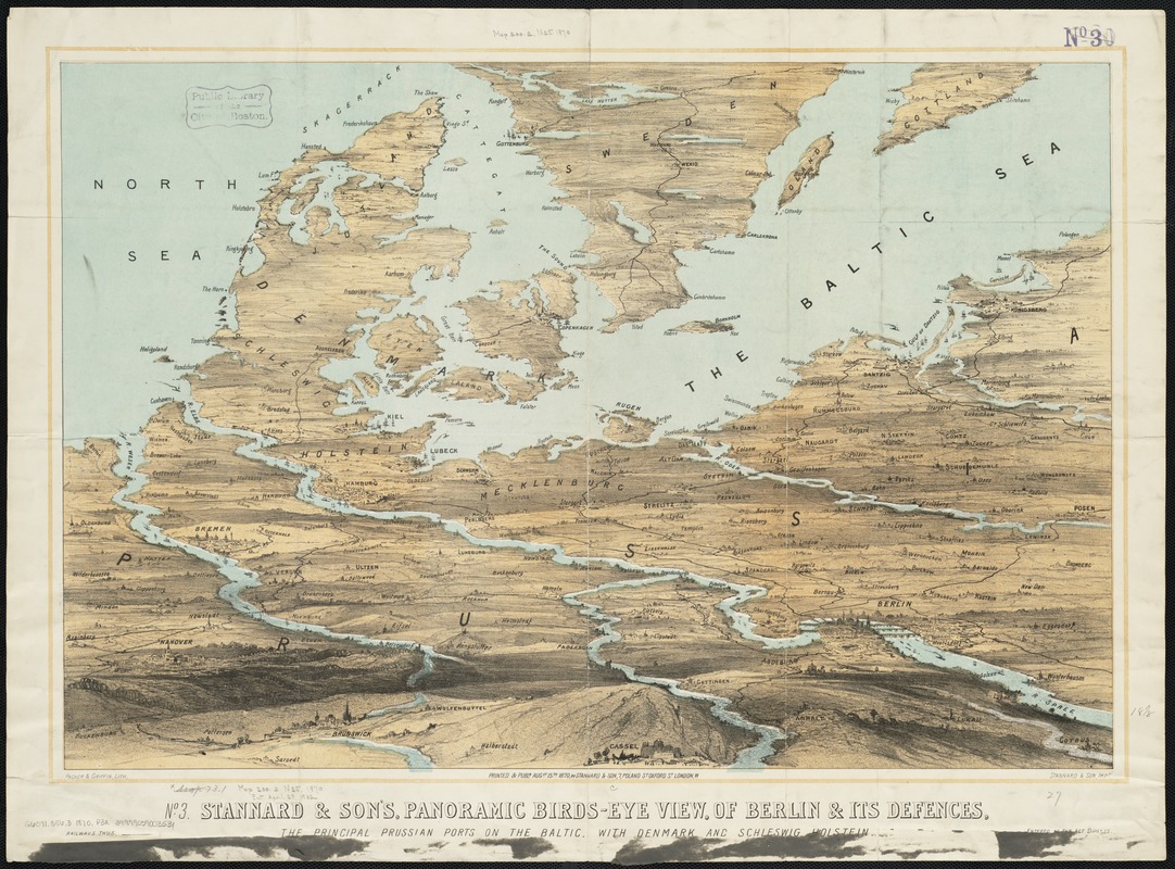
Stannard & Son's, panoramic birds-eye view, of Berlin & its defences, the principal Prussian ports on the Baltic, with Denmark and Schleswig Holstein
Item Information
- Title:
- Stannard & Son's, panoramic birds-eye view, of Berlin & its defences, the principal Prussian ports on the Baltic, with Denmark and Schleswig Holstein
- Title (alt.):
-
No. 3 Stannard & Son's, panoramic birds-eye view, of Berlin & its defences, the principal Prussian ports on the Baltic, with Denmark and Schlesing Holstein
Panoramic birds-eye view, of Berlin & its defences, the principal Prussian ports on the Baltic, with Denmark and Schlesing Holstein
- Name on Item:
-
Packer & Griffin lith. ; Stannard & Son impt.
- Date:
-
1870
- Format:
-
Maps/Atlases
- Location:
-
Boston Public Library
Norman B. Leventhal Map Center - Collection (local):
-
Norman B. Leventhal Map Center Collection
- Subjects:
-
Franco-Prussian War, 1870-1871--Aerial views
Denmark--History--1789-1900--Aerial views
Germany--History--1789-1900--Aerial views
- Places:
-
Germany
Denmark
- Extent:
- 1 view : col. ; 46 x 69 cm.
- Terms of Use:
-
No known copyright restrictions.
No known restrictions on use.
- Publisher:
-
London :
Stannard & Son
- Scale:
-
Not drawn to scale.
- Language:
-
English
- Notes:
-
Relief shown by shading.
- Identifier:
-
06_01_004022
- Call #:
-
G6071.S56.3 1870 .P3x
- Barcode:
-
39999059003531


