Boston : 1899
Item Information
- Title:
- Boston : 1899
- Description:
-
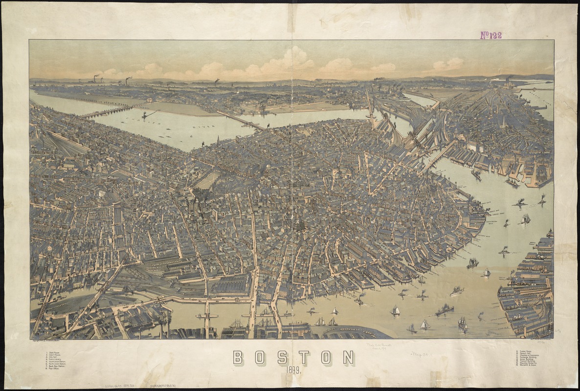
By the time this aerial view was published, the filling in and development of Back Bay was nearly complete, doubling the original size of the city. The Common and Public Garden are centrally located, with the new Back Bay neighborhood to the west. The burned district has not only been rebuilt, but has expanded to include a bustling waterfront, illustrating how Boston was an important regional commercial hub. As Boston’s business district grew, public places and green spaces had to be developed on the edges of the urbanized area.
- Creator:
- Downs, A. E. (Albert E.)
- Name on Item:
-
By E. A. [sic] Downs ; Geo. H. Walker & Co. Lith.
- Date:
-
[ca. 1899]
- Format:
-
Maps/Atlases
- Location:
-
Boston Public Library
Norman B. Leventhal Map Center - Collection (local):
-
Norman B. Leventhal Map Center Collection
- Subjects:
-
Boston (Mass.)--Aerial views
- Places:
-
Suffolk (county)Boston
- Extent:
- 1 view : col. ; 55 x 96 cm.
- Terms of Use:
-
No known copyright restrictions.
No known restrictions on use.
- Publisher:
-
Boston :
A.E. Downs
- Scale:
-
Not drawn to scale.
- Language:
-
English
- Notes:
-
Bird's-eye view.
Indexed for points of interest.
- Notes (exhibitions):
-
Exhibited: "Boston in the Gilded Age: Mapping Public Places" organized by the Norman B. Leventhal Map Center at the Boston Public Library, 2012-2013.
- Identifier:
-
06_01_004003
- Call #:
-
G3764.B6A3 1899 .D6
- Barcode:
-
39999059003374
- LCCN:
-
75694558


