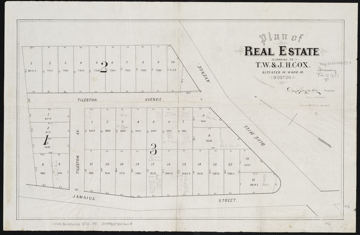
Plan of real estate belonging to T.W. & J.H. Cox : situated in ward 16, Boston
Item Information
- Title:
- Plan of real estate belonging to T.W. & J.H. Cox : situated in ward 16, Boston
- Name on Item:
-
David Granger & Son, surveyors.
- Date:
-
[1870–1880]
- Format:
-
Maps/Atlases
- Location:
-
Boston Public Library
Norman B. Leventhal Map Center - Collection (local):
-
Norman B. Leventhal Map Center Collection
- Subjects:
-
Real property--Massachusetts--Boston--Maps
Land tenure--Massachusetts--Boston--Maps
Dorchester (Boston, Mass.)--Maps
Dorchester (Boston, Mass.)
- Places:
-
Suffolk (county)BostonDorchester
- Extent:
- 1 plan ; 31 x 51 cm.
- Terms of Use:
-
No known copyright restrictions.
No known restrictions on use.
- Publisher:
-
Boston, Mass :
[s.n.]
- Scale:
-
Scale 1:600.
- Language:
-
English
- Notes:
-
Oriented with north toward the upper left.
- Notes (date):
-
This date is inferred.
- Identifier:
-
06_01_003957
- Call #:
-
G3764.B6:2D6G46 1870 .P5
- Barcode:
-
39999059003218

![[Plan of house lots for sale on Savin Hill Avenue, Dorchester, Mass.]](https://bpldcassets.blob.core.windows.net/derivatives/images/commonwealth:9s161f68b/image_thumbnail_300.jpg)


