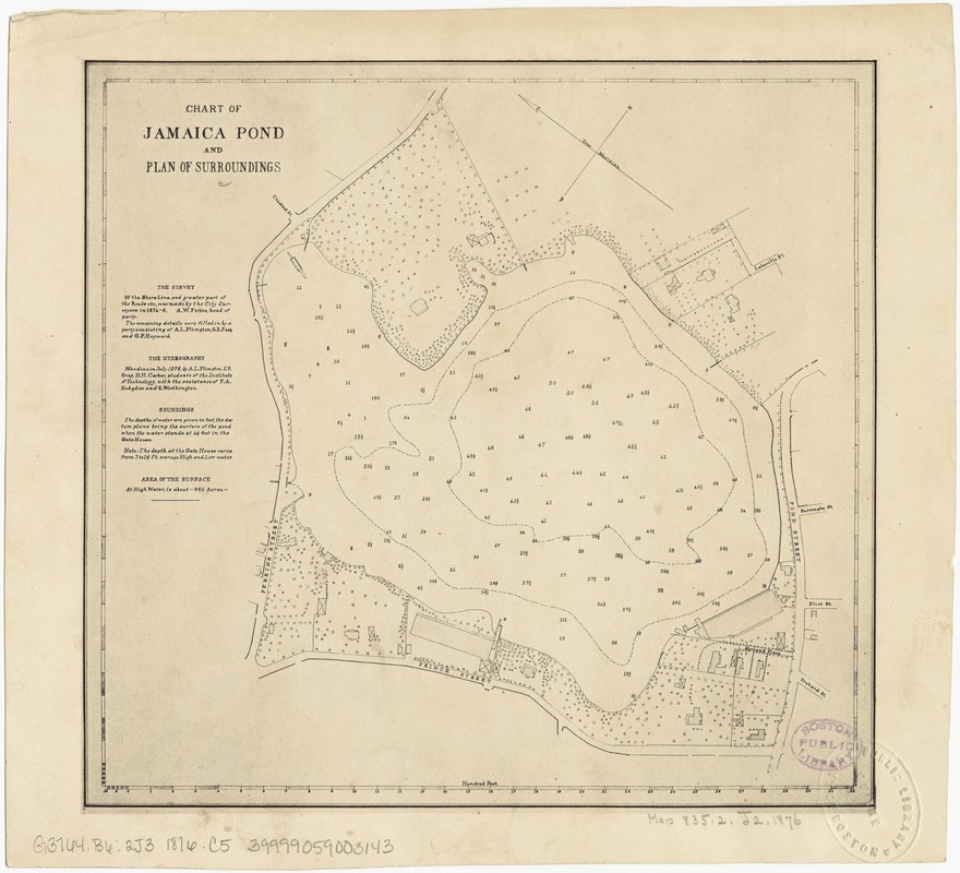
Chart of Jamaica Pond and plan of surroundings
Item Information
- Title:
- Chart of Jamaica Pond and plan of surroundings
- Date:
-
[1876]
- Format:
-
Maps/Atlases
- Location:
-
Boston Public Library
Norman B. Leventhal Map Center - Collection (local):
-
Norman B. Leventhal Map Center Collection
- Subjects:
-
Ponds--Massachusetts--Boston--Maps
Jamaica Plain (Boston, Mass.)--Maps
Jamaica Plain (Boston, Mass.)
- Places:
-
Suffolk (county)Jamaica Pond (lake)
- Extent:
- 1 plan ; 20 x 21 cm.
- Terms of Use:
-
No known copyright restrictions.
No known restrictions on use.
- Publisher:
-
Boston, Mass :
Engineering Dept.
- Scale:
-
Scale not given.
- Language:
-
English
- Notes:
-
Facsimile.
Oriented with north toward the upper left.
Depths shown by soundings.
"The survey of the shore line and greater part of the road etc., was made by the City Surveyor in 1874-6..."
- Notes (date):
-
This date is inferred.
- Identifier:
-
06_01_003950
- Call #:
-
G3764.B6:2J3 1876 .C5
- Barcode:
-
39999059003143


