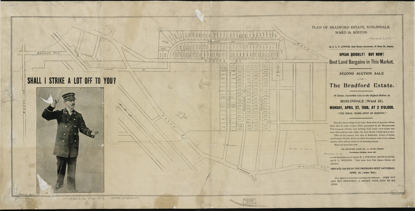
Plan of Bradford Estate, Roslindale, Ward 23, Boston
Item Information
- Title:
- Plan of Bradford Estate, Roslindale, Ward 23, Boston
- Name on Item:
-
by L.L.P. Atwood.
- Date:
-
1896
- Format:
-
Maps/Atlases
- Location:
-
Boston Public Library
Norman B. Leventhal Map Center - Collection (local):
-
Norman B. Leventhal Map Center Collection
- Subjects:
-
Real property--Massachusetts--Boston--Maps
Land tenure--Massachusetts--Boston--Maps
Roslindale (Boston, Mass.)--Maps
Roslindale (Boston, Mass.)
- Places:
-
Suffolk (county)BostonRoslindale
- Extent:
- 1 plan ; 34 x 74 cm.
- Terms of Use:
-
No known copyright restrictions.
No known restrictions on use.
- Publisher:
-
Boston, Mass :
[Bradford Lands Co.]
- Scale:
-
Scale [1:2,400].
- Language:
-
English
- Identifier:
-
06_01_003940
- Call #:
-
G3764.B6:2R6 1896 .P5x
- Barcode:
-
39999059002707


