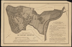
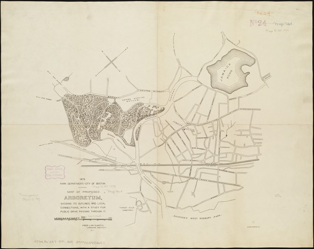
Map of proposed arboretum, showing its outlines and local connections, with a study for public drive passing through it
Item Information
- Title:
- Map of proposed arboretum, showing its outlines and local connections, with a study for public drive passing through it
- Creator:
- Boston (Mass.). Park Commissioners
- Name on Item:
-
Walter Stranders, del.
- Date:
-
1879
- Format:
-
Maps/Atlases
- Location:
-
Boston Public Library
Norman B. Leventhal Map Center - Collection (local):
-
Norman B. Leventhal Map Center Collection
- Subjects:
-
Arnold Arboretum--Maps
Parks--Massachusetts--Boston--Jamaica Plain--Maps
Jamaica Plain (Boston, Mass.)--Maps
- Places:
-
Suffolk (county)BostonJamaica Plain
Arnold Arboretum
- Extent:
- 1 map ; 49 x 61 cm.
- Terms of Use:
-
No known copyright restrictions.
No known restrictions on use.
- Publisher:
-
Boston, Mass :
[s.n.]
- Scale:
-
Scale 1:7,200.
- Language:
-
English
- Notes:
-
Oriented with north toward the upper right.
"Fredk. Law Olmsted, landscape architect."
- Identifier:
-
06_01_003934
- Call #:
-
G3764.B6:2A7 1879 .B67
- Barcode:
-
39999059002657