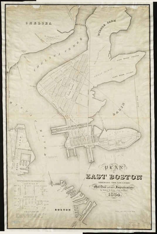
Plan of East Boston : shewing the location of a mill dam and other improvements
Item Information
- Title:
- Plan of East Boston : shewing the location of a mill dam and other improvements
- Creator:
- Eddy, R. H. (Robert Henry), 1812-1887
- Name on Item:
-
by Robert H. Eddy, civil engineer.
- Date:
-
1834
- Format:
-
Maps/Atlases
- Location:
-
Boston Public Library
Norman B. Leventhal Map Center - Collection (local):
-
Norman B. Leventhal Map Center Collection
- Subjects:
-
Real property--Massachusetts--Boston--Maps
Land tenure--Massachusetts--Boston--Maps
East Boston (Boston, Mass.)--Maps
East Boston (Boston, Mass.)
- Places:
-
Suffolk (county)BostonEast Boston
- Extent:
- 1 map ; 90 x 57 cm.
- Terms of Use:
-
No known copyright restrictions.
No known restrictions on use.
- Publisher:
-
Boston, Mass :
Pendleton's Lithography
- Scale:
-
Scale [1:4,800].
- Language:
-
English
- Notes:
-
Partial cadastral map showing lot numbers and names of some property owners.
Oriented with north toward the upper left.
"Drawn on stone by J. Eddy."
"Sept. 1, 1834."
Includes table of lot sizes.
- Identifier:
-
06_01_003885
- Call #:
-
G3764.B6:2E2 1834 .E3
- Barcode:
-
39999059006740


