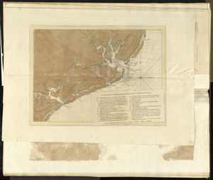
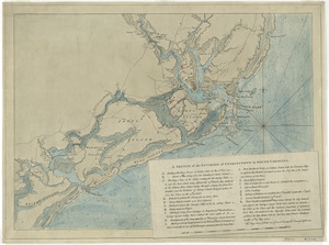
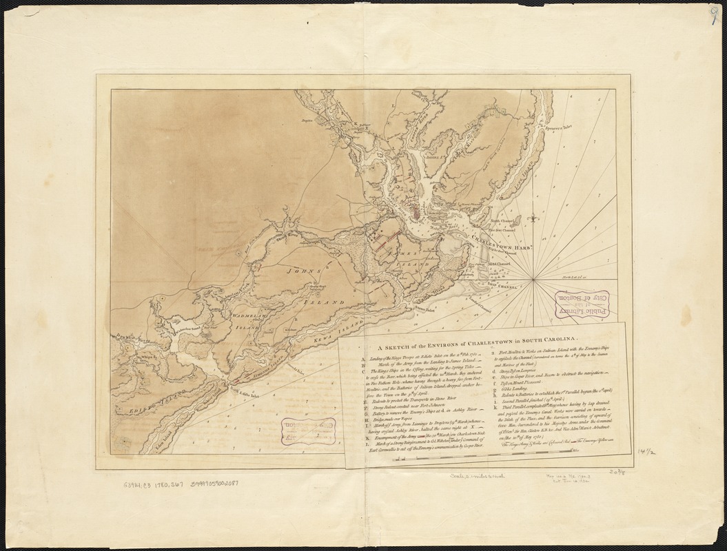
A sketch of the environs of Charlestown in South Carolina
This map is also available in American Revolutionary Geographies Online (ARGO), a collections portal especially built for material relating to the American Revolutionary War Era. Visit ARGO to learn more about this item and explore the historical geography of North America in the late eighteenth century.
Item Information
- Title:
- A sketch of the environs of Charlestown in South Carolina
- Creator:
- Sproule, George, 1741-1817
- Date:
-
[1780]
- Format:
-
Maps/Atlases
- Location:
-
Boston Public Library
Norman B. Leventhal Map Center - Collection (local):
-
Norman B. Leventhal Map Center Collection
- Subjects:
-
Charleston (S.C.)--History--Revolution, 1775-1783--Maps--Early works to 1800
South Carolina--History--Revolution, 1775-1783--Maps--Early works to 1800
- Places:
-
Charleston (county)Charleston
- Extent:
- 1 map : hand col. ; 38 x 52 cm.
- Terms of Use:
-
No known copyright restrictions.
No known restrictions on use.
- Publisher:
-
London :
s.n.
- Scale:
-
Scale [ca. 1:132,000]
- Language:
-
English
- Notes:
-
Relief shown by shading. Depths shown by soundings.
Includes index to events and points of interest.
Second state, lacking imprint and with additional references.
- Notes (date):
-
This date is inferred.
- Identifier:
-
06_01_003780
- Call #:
-
G3914.C3 1780 .S67
- Barcode:
-
39999059002087