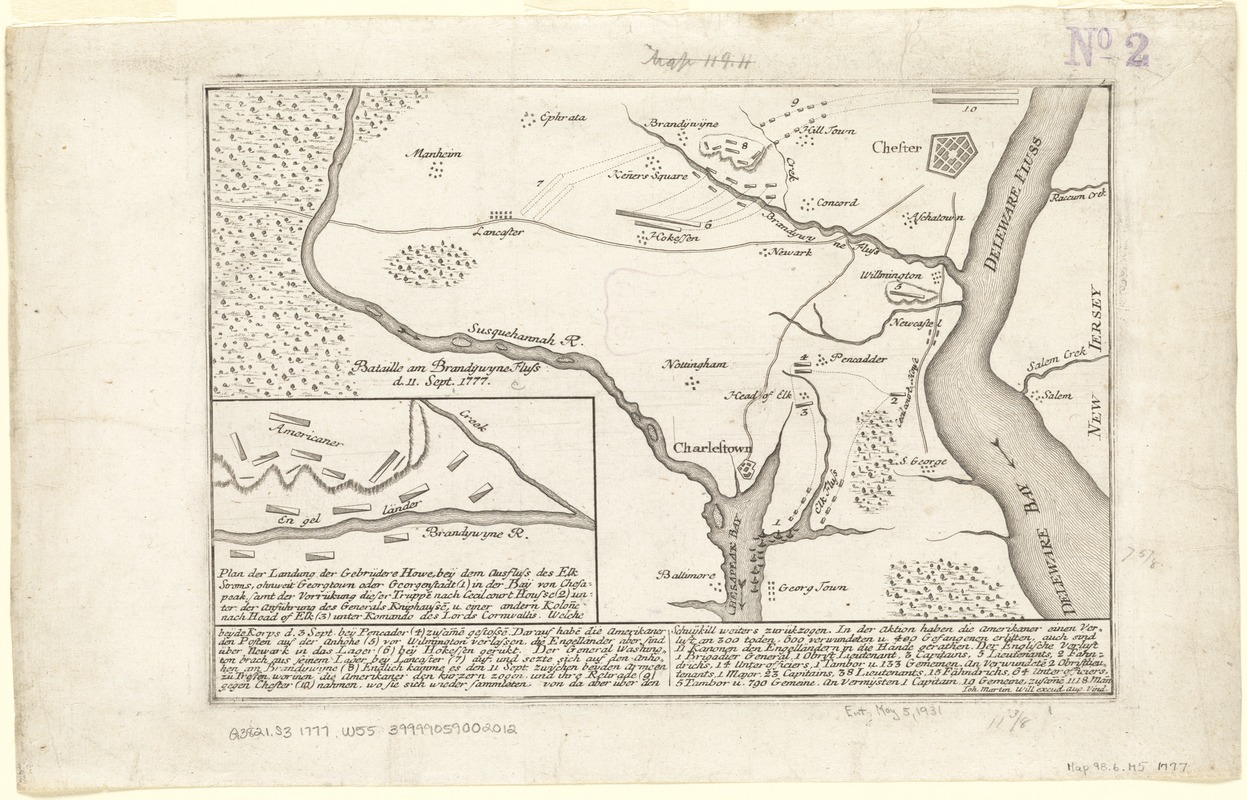
Plan der landung der Gebrüdere Howe, bey dem ausfluss des Elk Strom ...Lords Cornwallis
This map is also available in American Revolutionary Geographies Online (ARGO), a collections portal especially built for material relating to the American Revolutionary War Era. Visit ARGO to learn more about this item and explore the historical geography of North America in the late eighteenth century.
Item Information
- Title:
- Plan der landung der Gebrüdere Howe, bey dem ausfluss des Elk Strom ...Lords Cornwallis
- Creator:
- Will, Johann Martin, 1727-1806
- Name on Item:
-
Ioh. Martin Will excud.
- Date:
-
[1777]
- Format:
-
Maps/Atlases
- Location:
-
Boston Public Library
Norman B. Leventhal Map Center - Collection (local):
-
Norman B. Leventhal Map Center Collection
- Subjects:
-
Brandywine, Battle of, Pa., 1777--Maps--Early works to 1800
Pennsylvania--History--Revolution, 1775-1783--Maps--Early works to 1800
Maryland--History--Revolution, 1775-1783--Maps--Early works to 1800
United States--History--Revolution, 1775-1783--Maps--Early works to 1800
Howe, William Howe, Viscount, 1729-1814
- Places:
-
PennsylvaniaDelaware (county)Chadds Ford
Brandywine Battlefield
- Extent:
- 1 plan ; 20 x 29 cm.
- Terms of Use:
-
No known copyright restrictions.
No known restrictions on use.
- Publisher:
-
Augsburg :
Will
- Scale:
-
Scale not given.
- Language:
-
German
- Notes:
-
Relief shown by hachures.
"1" in upper right corner.
Plan of Pennsylvania and Maryland, showing the fortifications for the Battle of Brandywine, under Gen. William Howe and Gen. George Washington.
- Notes (date):
-
This date is inferred.
- Identifier:
-
06_01_003765
- Call #:
-
G3821.S3 1777 .W55
- Barcode:
-
39999059002012


