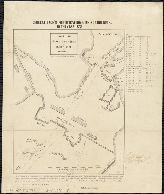
Exact plan of General Gage's lines on Boston Neck in America
This map is also available in American Revolutionary Geographies Online (ARGO), a collections portal especially built for material relating to the American Revolutionary War Era. Visit ARGO to learn more about this item and explore the historical geography of North America in the late eighteenth century.
Item Information
- Title:
- Exact plan of General Gage's lines on Boston Neck in America
- Title (alt.):
-
General Gage's fortifications on Boston Neck, in the year 1775
- Creator:
- Aitken, Robert, 1735-1802
- Date:
-
[1775?]
- Format:
-
Maps/Atlases
- Location:
-
Boston Public Library
Norman B. Leventhal Map Center - Collection (local):
-
Norman B. Leventhal Map Center Collection
- Subjects:
-
Fortification--Massachusetts--Boston--Maps--Early works to 1800
Boston (Mass.)--History--Siege, 1775-1776--Maps--Early works to 1800
Gage, Thomas, 1721-1787
- Places:
-
Suffolk (county)Boston
- Extent:
- 1 plan ; 29 x 23 cm., on sheet 39 x 32 cm.
- Terms of Use:
-
No known copyright restrictions.
No known restrictions on use.
- Publisher:
-
Philadelphia :
R. Aitken
- Scale:
-
Scale ca. 1:3,500.
- Language:
-
English
- Notes:
-
Oriented with north toward the upper right.
"Copied from the Pennsylvania Magazine."
"This is a true state, this day, July 31, 1775, Pennsylvania Magazine, R. Aitken, publisher."
- Identifier:
-
06_01_003757
- Call #:
-
G3764.B6S3 1775 .A41
- Barcode:
-
39999059001915


