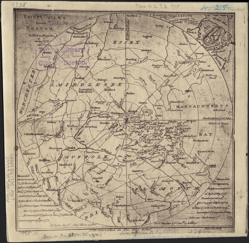
Thirty-miles round Boston
This map is also available in American Revolutionary Geographies Online (ARGO), a collections portal especially built for material relating to the American Revolutionary War Era. Visit ARGO to learn more about this item and explore the historical geography of North America in the late eighteenth century.
Item Information
- Title:
- Thirty-miles round Boston
- Creator:
- Armstrong, Mostyn John.
- Name on Item:
-
by M. Armstrong ; A. Bell, sc.
- Date:
-
[1775?]
- Format:
-
Maps/Atlases
- Location:
-
Boston Public Library
Norman B. Leventhal Map Center - Collection (local):
-
Norman B. Leventhal Map Center Collection
- Subjects:
-
Boston (Mass.)--Maps--Early works to 1800
- Places:
-
Suffolk (county)Boston
- Extent:
- 1 map ; 23 x 23 cm.
- Terms of Use:
-
No known copyright restrictions.
No known restrictions on use.
- Publisher:
-
S.l :
s.n.
- Scale:
-
Scale ca. 1:437,184.
- Language:
-
English
- Notes:
-
Facsimile.
Relief indicated pictorially and by hachures.
Inset: Action near Charlestown.
"Price one shill."
Originally appeared in The Scots magazine, v. 37, p. 440 (Edinburgh, 1775) -- cf. Phillips, P.L. Maps of America, p. 150; Guthorn, P.J. British maps of the American Revolution, 158.
- Identifier:
-
06_01_003722
- Call #:
-
G3764.B6 1775 .A76
- Barcode:
-
39999059001766


