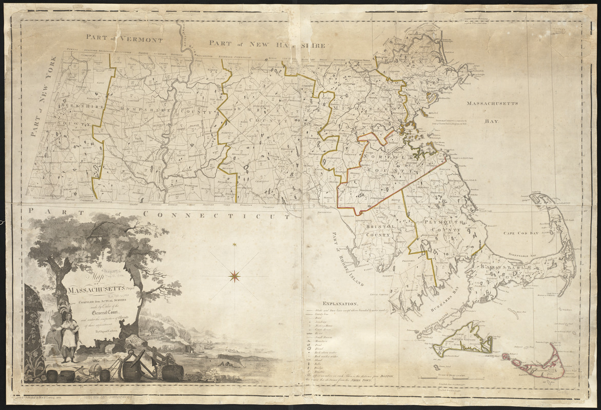
Map of Massachusetts proper
Item Information
- Title:
- Map of Massachusetts proper
- Creator:
- Carleton, Osgood, 1742-1816
- Contributor:
- Callender, Joseph, 1751-1821
- Contributor:
- Graham, George, fl. 1788-1813
- Contributor:
- Hill, Samuel, approximately 1766-1804
- Name on Item:
-
compiled from actual surveys made by order of the General Court, and under the inspection of agents of their appointment ; by Osgood Carelton ; engraved by Joseph Callender and Samuel Hill ; vignette drawn by G. Graham
- Date:
-
1802
- Format:
-
Maps/Atlases
- Location:
-
Boston Public Library
Norman B. Leventhal Map Center - Collection (local):
-
Norman B. Leventhal Map Center Collection
- Subjects:
-
Massachusetts--Maps
- Places:
-
Massachusetts
- Extent:
- 1 map : col. ; 76 x 114 cm.
- Terms of Use:
-
No known copyright restrictions.
No known restrictions on use.
- Publisher:
-
Boston :
[B. & J. Loring]
- Scale:
-
Scale 1:253,000
- Language:
-
English
- Notes:
-
Shows distance of each town from Boston and the shire town.
- Identifier:
-
06_01_003693
- Call #:
-
G3760 1802 .C37
- Barcode:
-
39999059001733


