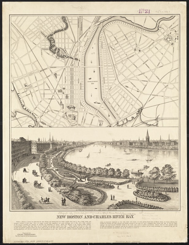
New Boston and Charles River Bay
Item Information
- Title:
- New Boston and Charles River Bay
- Date:
-
[1886]
- Format:
-
Maps/Atlases
- Location:
-
Boston Public Library
Norman B. Leventhal Map Center - Collection (local):
-
Norman B. Leventhal Map Center Collection
- Subjects:
-
Boston (Mass.)--Maps
Boston (Mass.)--Aerial views
Charles River (Mass.)--Maps
Charles River (Mass.)--Aerial views
Davenport, Charles
Coolidge, Albert L.
- Places:
-
Charles (river)
Suffolk (county)Boston
- Extent:
- 1 map ; on sheet 68 x 52 cm.
- Terms of Use:
-
No known copyright restrictions.
No known restrictions on use.
- Publisher:
-
Boston, Mass :
J.H. Bufford's
- Scale:
-
Scale not given.
- Language:
-
English
- Notes:
-
Includes both a map and an aerial view of the Back Bay and surrounding area, with description.
Appears in Map and Description of The New Boston, the Metropolis of New England and the Charles River Bay. Boston : Rand, Avery & Co., 1886.
"Engraved for Chas. Davenport, the first projector of the embankment."
- Notes (date):
-
This date is inferred.
- Identifier:
-
06_01_003627
- Call #:
-
G3764.B6:2E8 1886 .N49
- Barcode:
-
39999059001659


