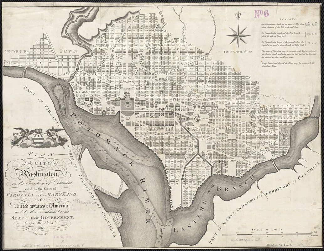
Plan of the city of Washington, in the territory of Columbia, ceded by the States of Virginia and Maryland to the United States of America, and by them established as the seat of their government after the year 1800
This map is also available in American Revolutionary Geographies Online (ARGO), a collections portal especially built for material relating to the American Revolutionary War Era. Visit ARGO to learn more about this item and explore the historical geography of North America in the late eighteenth century.
Item Information
- Title:
- Plan of the city of Washington, in the territory of Columbia, ceded by the States of Virginia and Maryland to the United States of America, and by them established as the seat of their government after the year 1800
- Creator:
- Russell, John, fl. 1733-1795
- Name on Item:
-
J. Russell, sculpt., Constitu'n Row, Grays Inn Road.
- Date:
-
[1795]
- Format:
-
Maps/Atlases
- Location:
-
Boston Public Library
Norman B. Leventhal Map Center - Collection (local):
-
Norman B. Leventhal Map Center Collection
- Subjects:
-
Washington (D.C.)--Maps
Georgetown (Washington, D.C.)--Maps
- Places:
-
WashingtonGeorgetown
- Extent:
- 1 map ; 40 x 53 cm.
- Terms of Use:
-
No known copyright restrictions.
No known restrictions on use.
- Publisher:
-
London :
s.n.
- Scale:
-
Scale 1:19,800.
- Language:
-
English
- Notes:
-
Relief shown by hachures.
Depths shown by soundings.
Shows block numbers and proposed government buildings.
Also covers Georgetown.
From the author's An American atlas, London, 1795.
Includes "Remarks" and coat-of-arms.
- Notes (date):
-
This date is inferred.
- Identifier:
-
06_01_003596
- Call #:
-
G3850 1795 .R887
- Barcode:
-
39999059001618
- LCCN:
-
gm 71002258


