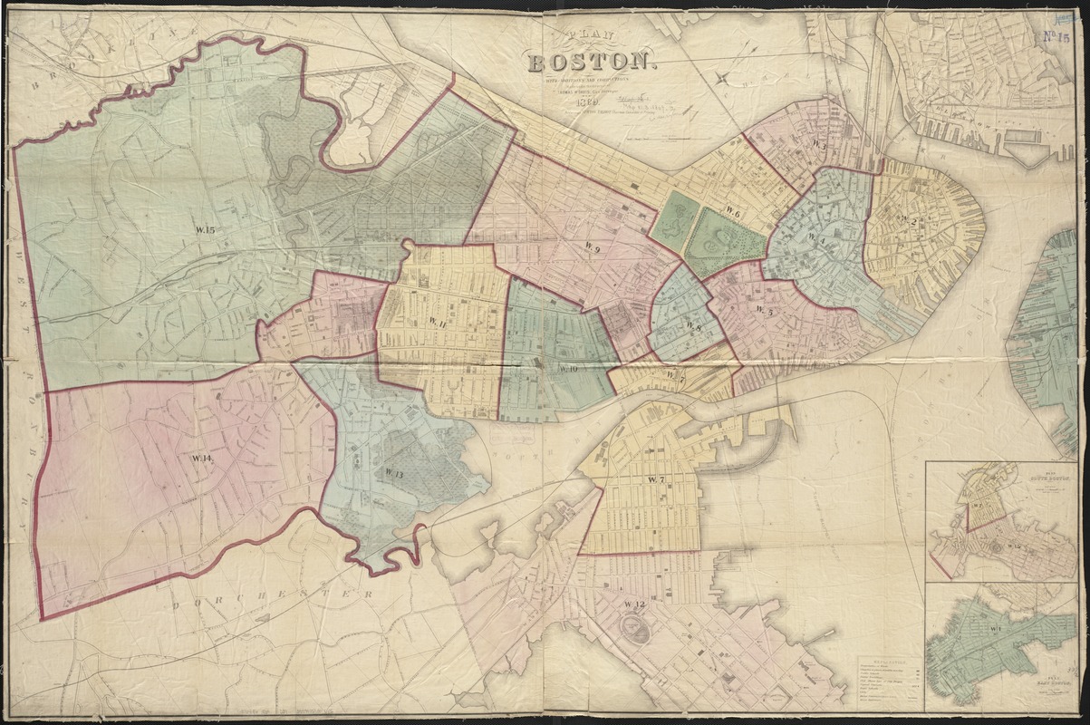
Plan of Boston, with additions and corrections
Item Information
- Title:
- Plan of Boston, with additions and corrections
- Creator:
- Davis, Thomas W., surveyor
- Date:
-
1869
- Format:
-
Maps/Atlases
- Location:
-
Boston Public Library
Norman B. Leventhal Map Center - Collection (local):
-
Norman B. Leventhal Map Center Collection
- Subjects:
-
Boston (Mass.)--Maps
- Places:
-
Suffolk (county)Boston
- Extent:
- 1 map : col. ; 84 x 128 cm.
- Terms of Use:
-
No known copyright restrictions.
No known restrictions on use.
- Publisher:
-
Boston, Mass :
[s.n.]
- Scale:
-
Scale 1:60,000.
- Language:
-
English
- Notes:
-
Oriented with north toward the upper right.
Relief shown by hachures.
Insets: Plan of South Boston and Plan of East Boston.
- Identifier:
-
06_01_003486
- Call #:
-
G3764.B6 1869 .D39
- Barcode:
-
39999059001345


