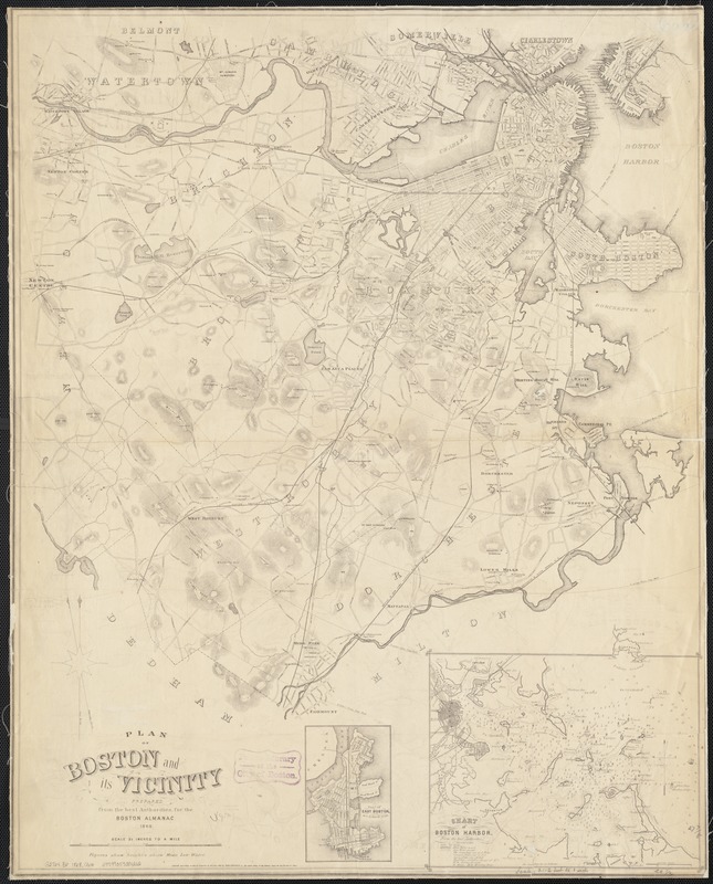
Plan of Boston and its vicinity
Item Information
- Title:
- Plan of Boston and its vicinity
- Creator:
- Coolidge, George, 1817-1888
- Name on Item:
-
prepared from the best authorities for the Boston almanac.
- Date:
-
1868
- Format:
-
Maps/Atlases
- Location:
-
Boston Public Library
Norman B. Leventhal Map Center - Collection (local):
-
Norman B. Leventhal Map Center Collection
- Subjects:
-
Boston (Mass.)--Maps
- Places:
-
Suffolk (county)Boston
- Extent:
- 1 map ; 71 x 56 cm.
- Terms of Use:
-
No known copyright restrictions.
No known restrictions on use.
- Publisher:
-
Boston, Mass :
N.S. Dearborn
- Scale:
-
Scale [1:25,344].
- Language:
-
English
- Notes:
-
Relief shown by hachures and spot heights.
Depths shown by soundings.
Shows wards of Boston and radial distances from City Hall.
"Entered according to Act of Congress in the year 1867 by Geo. Coolidge in the Clerks Office of the District Court for the District of Mass."
From: The Boston almanac for the year ..., 1868.
Insets: Plan of East Boston on a reduced scale -- Chart of Boston Harbor from the best authorities, 1856.
- Identifier:
-
06_01_003474
- Call #:
-
G3764.B6 1868 .C66
- Barcode:
-
39999059001212


