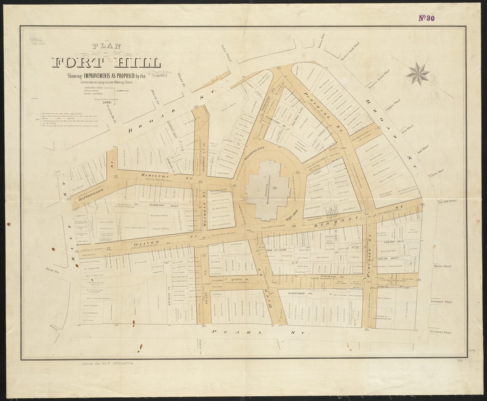
Plan of Fort Hill showing improvements as proposed by the Committee on laying out and widening streets
Item Information
- Title:
- Plan of Fort Hill showing improvements as proposed by the Committee on laying out and widening streets
- Creator:
- Boston (Mass.). Common Council
- Date:
-
1866
- Format:
-
Maps/Atlases
- Location:
-
Boston Public Library
Norman B. Leventhal Map Center - Collection (local):
-
Norman B. Leventhal Map Center Collection
- Subjects:
-
Boston (Mass.)--Maps
- Places:
-
Suffolk (county)Boston
- Extent:
- 1 map ; 73 x 98 cm.
- Terms of Use:
-
No known copyright restrictions.
No known restrictions on use.
- Publisher:
-
Boston, Mass :
[Common Council?]
- Scale:
-
Scale 1:480. 40 feet to an inch.
- Language:
-
English
- Notes:
-
Oriented with north toward the upper left.
- Identifier:
-
06_01_003472
- Call #:
-
G3764.B6 1866 .B675
- Barcode:
-
39999059001196


