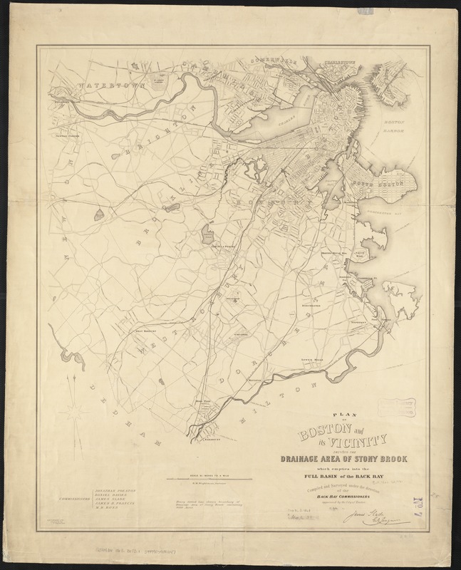
Plan of Boston and its vicinity, showing the drainage area of Stony Brook which empties into the full basin of the Back Bay
Item Information
- Title:
- Plan of Boston and its vicinity, showing the drainage area of Stony Brook which empties into the full basin of the Back Bay
- Creator:
- Back Bay (Boston (Mass.). Commissioners
- Name on Item:
-
compiled and surveyed under the direction of the Back Bay Commissioners appointed by the City of Boston by James Slade ; H.M. Wightman, Surveyor.
- Date:
-
[1863?]
- Format:
-
Maps/Atlases
- Location:
-
Boston Public Library
Norman B. Leventhal Map Center - Collection (local):
-
Norman B. Leventhal Map Center Collection
- Subjects:
-
Boston (Mass.)--Maps
- Places:
-
Suffolk (county)Boston
- Extent:
- 1 map ; 71 x 57 cm.
- Terms of Use:
-
No known copyright restrictions.
No known restrictions on use.
- Publisher:
-
Boston, Mass :
s.n.
- Scale:
-
Scale 1:25,344.
- Language:
-
English
- Notes:
-
Relief shown by hachures.
"J.E. Farwell & Co., printers to the City."
- Identifier:
-
06_01_003449
- Call #:
-
G3764.B6 1863 .B675
- Barcode:
-
39999059001147


