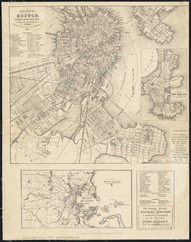
New map of Boston, comprising the whole city with the new boundariess of the wards
Item Information
- Title:
- New map of Boston, comprising the whole city with the new boundariess of the wards
- Name on Item:
-
engraved expressly for the Boston Pocket Directory 1863.
- Date:
-
[1863]
- Format:
-
Maps/Atlases
- Location:
-
Boston Public Library
Norman B. Leventhal Map Center - Collection (local):
-
Norman B. Leventhal Map Center Collection
- Subjects:
-
Boston (Mass.)--Maps
- Places:
-
Suffolk (county)Boston
- Extent:
- 1 map ; 25 x 28 cm., on sheet 37 x 29 cm.
- Terms of Use:
-
No known copyright restrictions.
No known restrictions on use.
- Publisher:
-
Boston, Mass :
W. Forbes & Co.
- Scale:
-
Scale not given.
- Language:
-
English
- Notes:
-
Includes index to points of interest.
Includes inset map: Plan of East Boston on a reduced scale and ancillary map: Map of Boston and vicinity, 1863.
- Notes (date):
-
This date is inferred.
- Identifier:
-
06_01_003446
- Call #:
-
G3764.B6 1863 .N49
- Barcode:
-
39999059001113


