Plan of extension of Devonshire Street connecting Otis & Winthrop Places
Item Information
- Title:
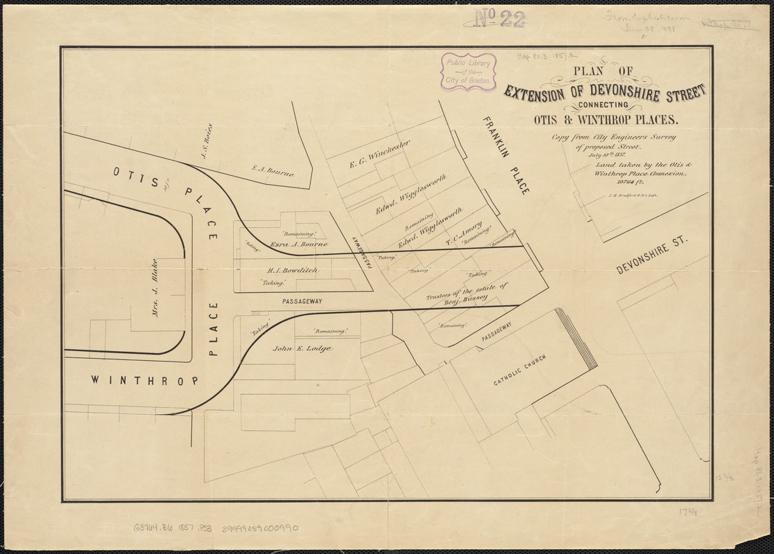
- Plan of extension of Devonshire Street connecting Otis & Winthrop Places
- Date:
-
1857
- Format:
-
Maps/Atlases
- Location:
-
Boston Public Library
Norman B. Leventhal Map Center - Collection (local):
-
Norman B. Leventhal Map Center Collection
- Subjects:
-
Boston (Mass.)--Maps
- Places:
-
Suffolk (county)Boston
- Extent:
- 1 map ; 32 x 45 cm.
- Terms of Use:
-
No known copyright restrictions.
No known restrictions on use.
- Publisher:
-
[Boston, Mass.] :
L.H. Bradford & Co.'s Lith.
- Scale:
-
Scale not given.
- Language:
-
English
- Notes:
-
Copy from City Engineer's survey of proposed street, July 10, 1857.
- Identifier:
-
06_01_003430
- Call #:
-
G3764.B6 1857 .P53
- Barcode:
-
39999059000990


