Plan of Washington Street showing proposed lines of widening from Warren to Kneeland : Oct. 1st 1860
Item Information
- Title:
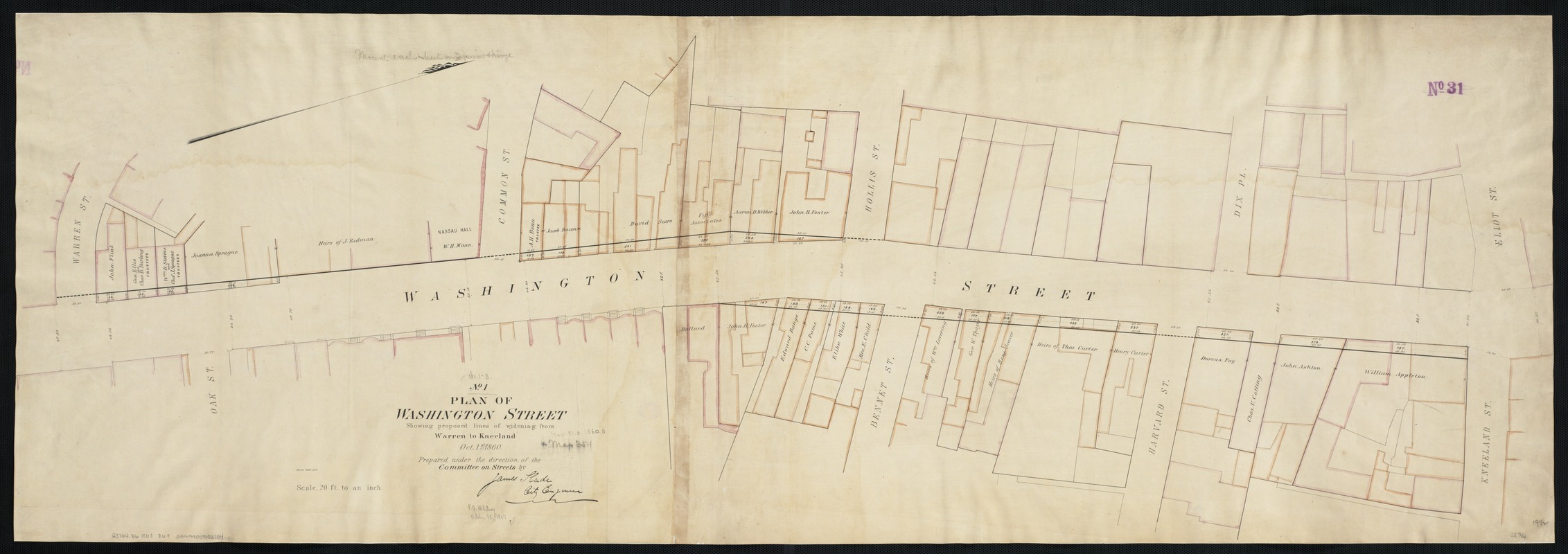
- Plan of Washington Street showing proposed lines of widening from Warren to Kneeland : Oct. 1st 1860
- Creator:
- Boston (Mass.). Engineering Dept
- Name on Item:
-
prepared under the direction of the Committee on Streets by James Slade City Engineer.
- Date:
-
1860
- Format:
-
Maps/Atlases
- Location:
-
Boston Public Library
Norman B. Leventhal Map Center - Collection (local):
-
Norman B. Leventhal Map Center Collection
- Subjects:
-
Roads--Massachusetts--Boston
Boston (Mass.)--Maps
- Places:
-
Suffolk (county)Boston
- Extent:
- 1 map : col. ; 49 x 141 cm.
- Terms of Use:
-
No known copyright restrictions.
No known restrictions on use.
- Publisher:
-
Boston, Mass :
[Engineering Dept.]
- Scale:
-
Scale 1:240.
- Language:
-
English
- Notes:
-
Oriented with north toward the upper right.
- Identifier:
-
06_01_003423
- Call #:
-
G3764.B6 1860 .B69
- Barcode:
-
39999059003754


