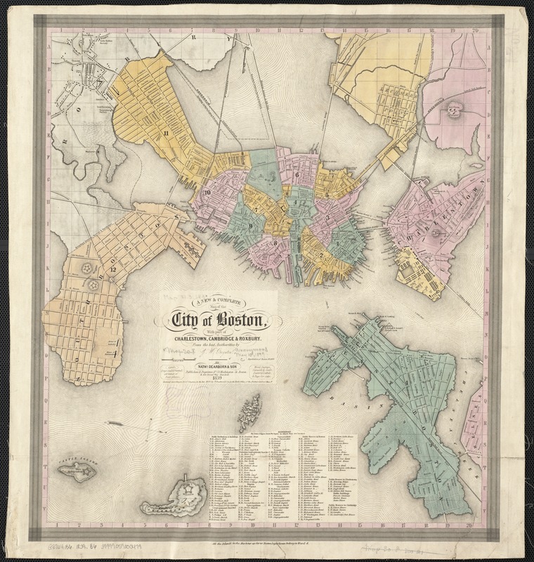
A new & complete map of the city of Boston, with part of Charlestown, Cambridge & Roxbury
Item Information
- Title:
- A new & complete map of the city of Boston, with part of Charlestown, Cambridge & Roxbury
- Title (alt.):
-
New and complete map of the city of Boston, with part of Charlestown, Cambridge & Roxbury
Dearborn's map of Boston
- Creator:
- Boynton, George W., d. 1884
- Name on Item:
-
from the best authorities by G. W. Boynton.
- Date:
-
1839
- Format:
-
Maps/Atlases
- Location:
-
Boston Public Library
Norman B. Leventhal Map Center - Collection (local):
-
Norman B. Leventhal Map Center Collection
- Subjects:
-
Charlestown (Boston, Mass.)--Maps
Roxbury (Boston, Mass.)--Maps
Boston (Mass.)--Maps
Cambridge (Mass.)--Maps
- Places:
-
Middlesex (county)Cambridge
Suffolk (county)BostonRoxbury
Suffolk (county)BostonCharlestown
- Extent:
- 1 map : col. ; 43 x 38 cm., folded in cover 13 x 9 cm.
- Terms of Use:
-
No known copyright restrictions.
No known restrictions on use.
- Publisher:
-
Boston, Mass :
Nathl. Dearborn & Son
- Scale:
-
Scale [ca. 1:17,000]
- Language:
-
English
- Notes:
-
Oriented with north toward the lower right.
Relief shown by hachures.
Includes index to points of interest.
Wards are numbered.
"Population of Boston 93,000."
- Identifier:
-
06_01_003322
- Call #:
-
G3764.B6 1839 .B6
- Barcode:
-
39999059000479


