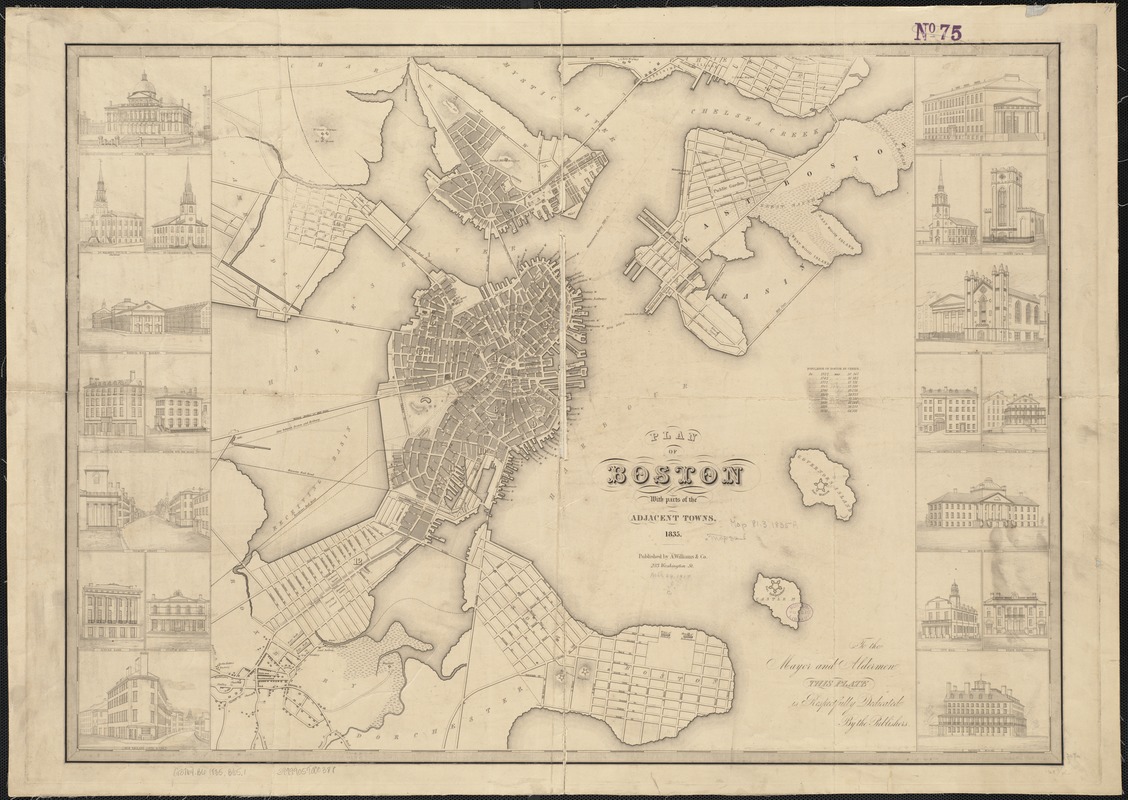
Plan of Boston with parts of the adjacent towns
Item Information
- Title:
- Plan of Boston with parts of the adjacent towns
- Date:
-
1835
- Format:
-
Maps/Atlases
- Location:
-
Boston Public Library
Norman B. Leventhal Map Center - Collection (local):
-
Norman B. Leventhal Map Center Collection
- Subjects:
-
Fortification--Massachusetts--Boston--Maps
Boston (Mass.)--Maps
Boston (Mass.)--Buildings, structures, etc--Maps
- Places:
-
Suffolk (county)Boston
- Extent:
- 1 map ; 52 x 73 cm.
- Terms of Use:
-
No known copyright restrictions.
No known restrictions on use.
- Publisher:
-
Boston, Mass :
A. Williams & Co.
- Scale:
-
Scale not given.
- Language:
-
English
- Notes:
-
Relief shown by hachures.
Includes population statistics.
Map is bordered by twenty finely rendered views of important public and business buildings.
- Identifier:
-
06_01_003316
- Call #:
-
G3764.B6 1835 .B652
- Barcode:
-
39999059000388


