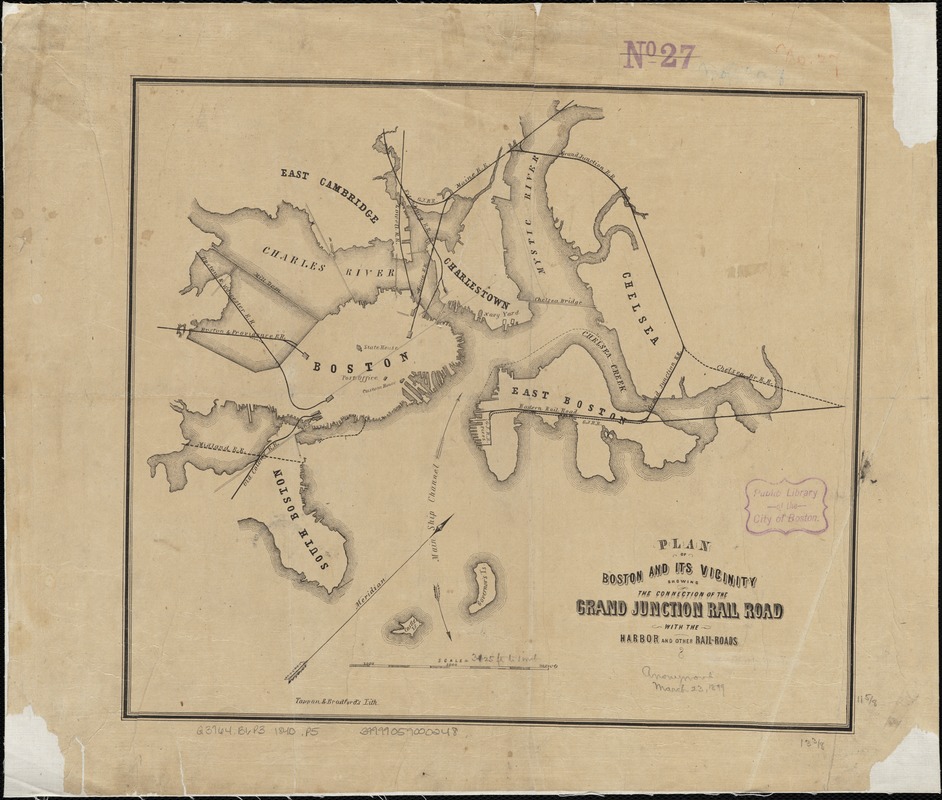
Plan of Boston and its vicinity showing the connection of the Grand Junction Rail Road with the Harbor and other Rail-roads
Item Information
- Title:
- Plan of Boston and its vicinity showing the connection of the Grand Junction Rail Road with the Harbor and other Rail-roads
- Date:
-
[1852]
- Format:
-
Maps/Atlases
- Location:
-
Boston Public Library
Norman B. Leventhal Map Center - Collection (local):
-
Norman B. Leventhal Map Center Collection
- Subjects:
-
Railroads--Massachusetts--Boston--Maps
Railroads--Massachusetts--Maps
Boston (Mass.)--Maps
Massachusetts--Maps
- Places:
-
Suffolk (county)Boston
- Extent:
- 1 map ; 30 x 34 cm.
- Terms of Use:
-
No known copyright restrictions.
No known restrictions on use.
- Publisher:
-
Boston, Mass :
Tappan & Bradford's Lith.
- Scale:
-
Scale [ca. 1:37,500].
- Language:
-
English
- Notes:
-
Oriented with north toward the upper right.
Later version of a map titled "Boston Harbor rail road termini" published in "Railroad jubilee" (Boston : J. H. Eastburn, 1852).
- Notes (date):
-
This date is inferred.
- Identifier:
-
06_01_003304
- Call #:
-
G3764.B6P3 1852 .P5
- Barcode:
-
39999059000248

![[Boston and Northwestern Junction Railroad]](https://bpldcassets.blob.core.windows.net/derivatives/images/commonwealth:x059cc74n/image_thumbnail_300.jpg)


