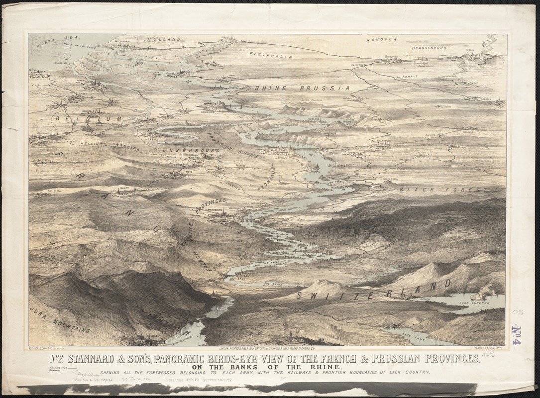
Stannard & Son's, panoramic birds-eye view of the French & Prussian provinces, on the banks of the Rhine, shewing all the fortresses belonging to each army, with the railways & frontier boundaries of each country
Item Information
- Title:
- Stannard & Son's, panoramic birds-eye view of the French & Prussian provinces, on the banks of the Rhine, shewing all the fortresses belonging to each army, with the railways & frontier boundaries of each country
- Title (alt.):
-
Panoramic birds-eye view of the French & Prussian provinces, on the banks of the Rhine, shewing all the fortresses belonging to each army, with the railways & frontier boundaries of each country
Panoramic birds-eye view of the French and Prussian provinces, on the banks of the Rhine, shewing all the fortresses belonging to each army, with the railways and frontier boundaries of each country
- Name on Item:
-
Packer & Griffin, del et lith. ; Stannard & Son, impt.
- Date:
-
1870
- Format:
-
Maps/Atlases
- Location:
-
Boston Public Library
Norman B. Leventhal Map Center - Collection (local):
-
Norman B. Leventhal Map Center Collection
- Subjects:
-
Franco-Prussian War, 1870-1871--Aerial views
France--History--1789-1900--Aerial views
Germany--History--1789-1900--Aerial views
- Places:
-
Germany
France
- Extent:
- 1 view : col. ; 45 x 68 cm.
- Terms of Use:
-
No known copyright restrictions.
No known restrictions on use.
- Publisher:
-
London :
Stannard & Son
- Scale:
-
Not drawn to scale.
- Language:
-
English
- Notes:
-
Relief shown by shading.
- Identifier:
-
06_01_003299
- Call #:
-
G5831.S56 1870 .P3
- Barcode:
-
39999059000198


